Saving gis imagery – Google Earth User Guide User Manual
Page 97
cropping parameters selected when importing the overlay. (See below for more information on scaling
or cropping an image.)
●
Images that exceed the maximum texture dimensions must be either cropped or scaled. A
dimension of 2048x2048 pixels is typically supported by high-end graphics cards, while on laptop
computers, the maximum dimension can be 1024x1024 or even less. (Very good cards can support up
to 4096x4096.)
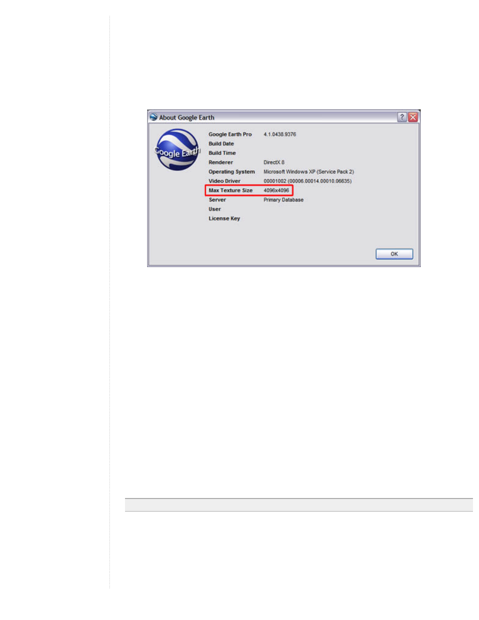
Determine the maximum allowable texture dimensions for your computer by selecting About Google
Earth under the Help menu. The texture size for your computer will be listed next to the Max Texture
size label.
Your image cannot exceed the dimension listed in the Max Texture label (in either direction).
If you try to import an image file that exceeds the allowable texture dimensions, a dialog box prompts
you to either scale or crop the image.
❍
Scale - This option scales and reprojects the entire image at the same time so that it preserves the
aspect ratio of the input image and fits the results in texture memory. The typical size for the
resultant image is 2048 pixels along the longest side.
❍
Crop - This option preserves the original resolution of the input image while creating a subset of
the original input file in order to fit it in texture memory.
When you select the crop option, the viewer flies to the location of the input image and contains the
extents of the input image. You then select the center point of the inset image you want to create. The
client computes a maximum area centered from the selected location.
●
For larger image files, reprojection can take some time.
If you have cropped or scaled an input image, or if you are reprojecting an image that uses more
texture memory, you will see a progress meter while the reprojection occurs. You can cancel the
operation at any time. Images that contain no projection information are treated as ordinary
overlay files.
In this case, you can position the image manually as you would an overlay image.
●
Images that contain incorrect or unsupported projection information will not be imported.
In this case, a dialog box indicates that the reprojection cannot be performed and the image will not be
imported.
Note - Currently, files using NAD83 projection are not supported by Google Earth.
Saving GIS Imagery
Once you have imported imagery data into Google Earth, you can save content changes made to the imported
GIS data as follows:
●
Move the imported imagery to remain in your My Places folder - If you have already placed the
imagery overlay within the My Places folder, any changes you make to it are automatically saved and
viewable each time you start Google Earth.