Chatsworth Products Remote Infrastructure Management (RIM-1000) User Manual
Page 110
Remote Infrastructure Management System - Version 1.0 / July 2014
110
www.chatsworth.com
3.4.26.1 Create An Interactive Map
Creating the interactive map requires access to several pages within the RIM-1000’s Configuration menu.
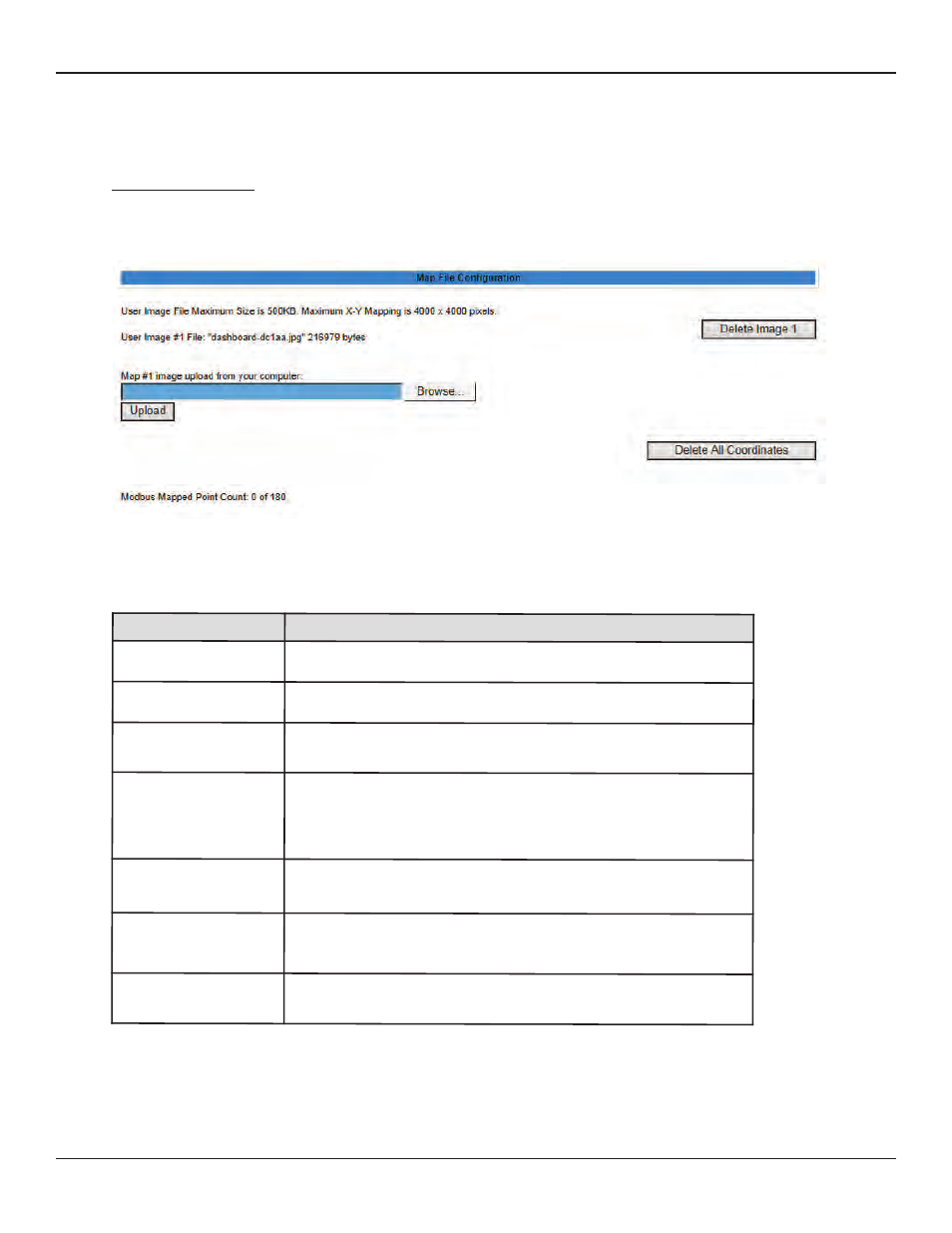
Upload the Map Image
To begin the mapping process, access the Configuration>Map page and upload your map image. Options on the Map page are
as follows:
Figure 3.52 Map Configuration Page
Table 3.28 Map Configuration Page Options
Option
Description
Browse
Click this button to select the map image on your computer.
Upload
Upload the selected image.
Delete Image #
The RIM-1000 can accommodate one map at a time. This button allows
you to delete a map that is already uploaded to the RIM-1000.
Delete All
Coordinates
If you have previously uploaded a map to the RIM-1000, you may also have
mapped coordinates for your monitored points and equipment.
Click this link to delete all previously mapped coordinates.
Mouseover Modbus
Units
Select Yes if you’d like descriptive information to pop up when you
mouseover Modbus Units on the map.
Mouseover Modbus
Points
Select Yes if you’d like descriptive information to pop up when you
mouseover Modbus Points on the map.
Mouseover Inputs
Select Yes if you’d like descriptive information to pop up when you
mouseover Inputs on the map.