Geographic geocoding – Pitney Bowes MapMarker USA User Manual
Page 89
Chapter 3:
Geographic Geocoding
MapMarker USA 25
89
User Guide
4. When through, click Done to view the log file or return to the MapMarker menu.
Geographic Geocoding
Geocoding to geographic centroids provides another fast alternative to street-level geocoding that
you can use when you do not need an exact match on the street address. Geographic geocoding is
less precise than street or postal geocoding, but may be suitable for certain applications. You can
also use geographic geocoding as a fallback option (see
MapMarker cannot match a record to the level or precision you originally requested (such as street
level).
For geographic geocoding, MapMarker returns the most precise geographic centroid that it can,
based on the user input.
To geocode to geographic centroids:
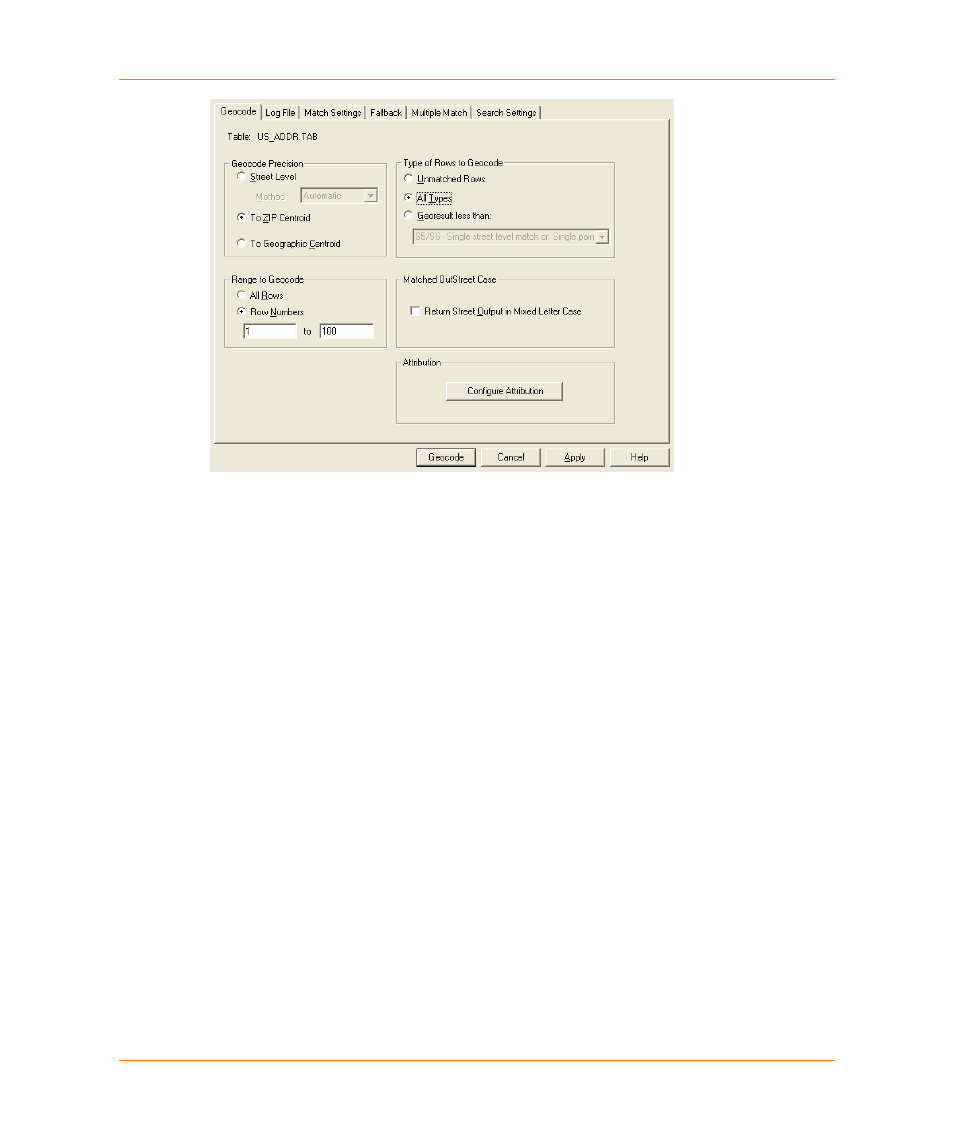
1. At the Geocode dialog in the Geocode Precision group, choose To Geographic Centroid.
2. Choose the range and type of rows you want to geocode.
3. Click Geocode.