Pitney Bowes MapMarker USA User Manual
Page 206
Creating a Custom User Dictionary
MapMarker USA 25
206
User Guide
5. Specify the required fields in the street table by highlighting a table column in the list box and
dragging it to the appropriate box in the address groups.
L
If you are creating a point-based user dictionary, make sure that your input table (TAB
file) has address point data and meets the requirements for left and right house number
data. See
Creating a Point User Dictionary on page 202
. Also make sure that your left
and right address number columns are mapped properly in the User Dictionary wizard.
When selecting the state field choose the field that contains the two-letter state abbreviation. Do
not use the 2-digit FIPS code field as the state field.
6. To clear any box, highlight
delete.
7. Click Next to continue. The User Dictionary Wizard (Step 3 of 3) dialog appears.
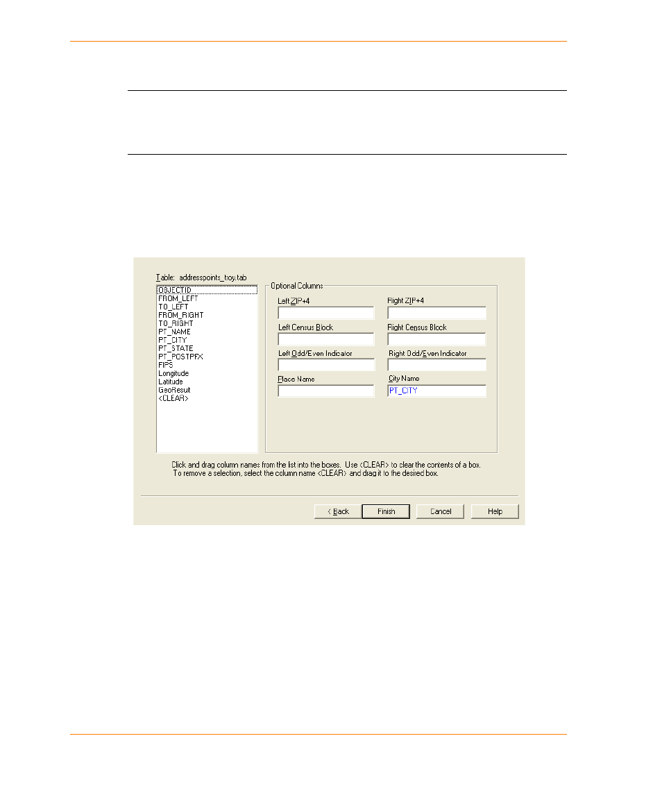
8. Specify any optional fields for City, ZIP + 4
®
, Census Block, Odd/Even Indicator, or place name
columns you wish to include in the dictionary. Including the Odd/Even Indicator allows for better
placement of address points when geocoding. A place name is a point object, rather that a street
segment. Examples include Sears Tower, Wrigley Field, or City Hall.
9. Click Finish to proceed or Back to revisit the previous dialogs. When you click Finish the Save
User Dictionary As dialog appears.
10. Specify the name and location of the User Dictionary and save in its own folder. For example,
you could create a UD folder under
C:\Program Files\MapInfo\
MapMarker_USA_v25\data\TroyUD
Save the newly created User Dictionary in this folder. This folder must be initially be empty.