Pitney Bowes MapMarker USA User Manual
Page 76
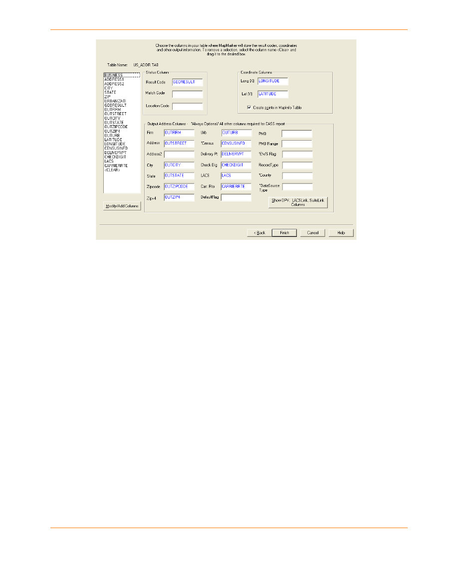
Selecting Input and Output Address Columns
MapMarker USA 25
76
User Guide
To avoid overwriting your input data, use output columns that have different names than the
corresponding input columns. If your output columns and input columns have the same name,
you receive a Warning message when you click Finish in
. If you click Yes, you will
overwrite your input data. Click No to change your output column selections.
2. In the Select output columns from your table dialog box, continue with the following steps, as
necessary.
a. If you do not want MapMarker to create points for your table, clear the check box marked
Create points in MapInfo table. In that case, you must select longitude and latitude columns
to proceed with geocoding. (Create points is not available if you are geocoding a text file
rather than a TAB file.)
b. If you are using CASS™ and want to generate a CASS report, all output fields with the
exception of asterisked fields are required. Note that this is not required for geocoding with
CASS, but only for generating a CASS report.
c. Identify a Census output column if you want MapMarker to return the Census Block code for
the matched address. MapMarker returns the code that represents the state and county FIPS
code, census tract, and tabulation block, depending on the match type.
d. You can optionally identify a County output column if you want MapMarker to return the name
of the county. You may need to add the County column to your output table.
e. If you are using DPV, LACS
Link
, or Suite
Link
, select Show DPV, LACSLink, SuiteLink
Columns. Note that the these columns are required for generating the CASS report (but not
required for CASS address matching).