Export to esri shapefile dialog – Pitney Bowes MapMarker USA User Manual
Page 231
Appendix A:
MapMarker Dialogs
MapMarker USA 25
231
User Guide
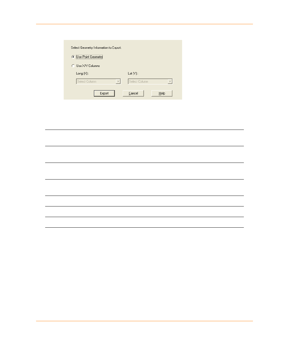
Export to ESRI Shapefile dialog
The Export to ESRI Shapefile dialog allows you to export TAB, DBF, CSV, and TXT files to ESRI
Shapefile (SHP) format.
Use Point Geometry
Specify that the geometry information will come from points on a
mappable table.
Use X/Y Coordinate
Columns
Specify that the geometry information will come from Longitude /
Latitude columns.
Long (X)
Use the drop-down list to choose the column that contains the
Longitude geometry.
Lat (Y)
Use the drop-down list to choose the column that contains the
Latitude geometry.
Export
Click Export to begin the export to SHP format.
Cancel
Cancels the operation and closes the dialog.
Help
Displays online help for this dialog.