Geocode dialog – Pitney Bowes MapMarker USA User Manual
Page 235
Appendix A:
MapMarker Dialogs
MapMarker USA 25
235
User Guide
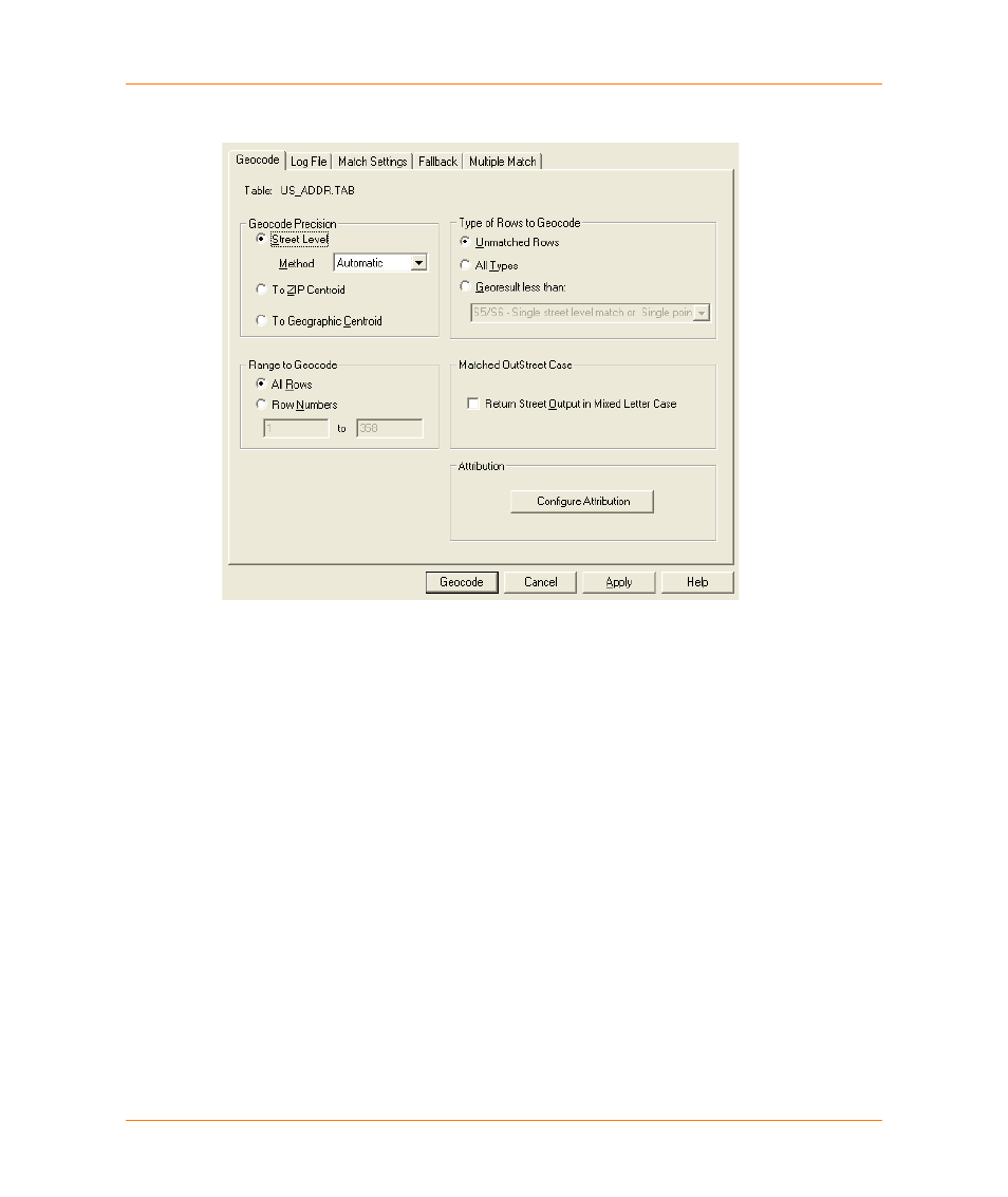
Geocode dialog
The Geocode dialog allows you to select a variety of preferences that control the method, precision,
range, and levels of geocoding. Use this dialog to set options for the current geocoding operation.
Table
Displays the name of the table to be geocoded.
Geocode Precision
Geocode to the specified level of precision (street level, ZIP
®
centroid or
Geographic Centroid).
Street Level
Geocode to street level.
Method
Choose from automatic (default) or interactive.
To ZIP Centroid
Geocode to the centroid of a ZIP Code™. This is faster than street level
geocoding.
To Geographic
Centroid
Geocode to the centroid of the geography (state, county, or city). These
are not very specific geocoding options, but may be suitable for certain
applications.
Range to Geocode
Use the options in this group to specify which rows in your table to
geocode.
Search City
Limits the search to the specified city.