Cass report optional fields, Geocoding in cass mode, Cass report optional fields geocoding in cass mode – Pitney Bowes MapMarker USA User Manual
Page 140
CASS Geocoding
MapMarker USA 25
140
User Guide
CASS Report Optional Fields
•
Latitude – Float or Decimal (10,6)
•
Longitude – Float or Decimal (11,6)
•
Census – Character(15)
•
EWS Flag – Character(1)
•
County
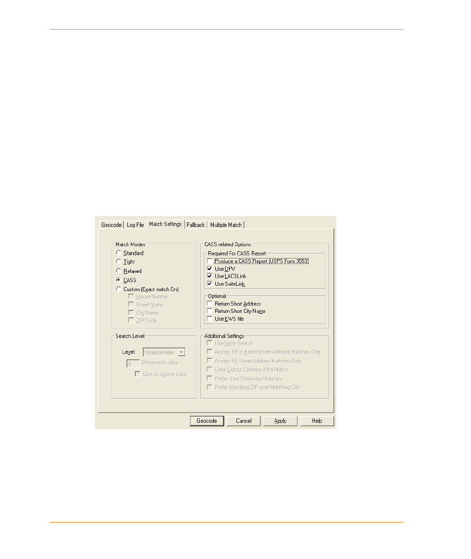
Geocoding in CASS Mode
To geocode in CASS™ mode, do the following:
1. Start MapMarker.
2. Open the table you want to geocode. Proceed through the Select Column dialogs.
3. On the Geocode dialog box, select the Match Settings tab.
4. In the Match Settings group, select the CASS Match Mode.
5. Select the CASS option that you want to use.
6. To produce a U.S. Postal Service
®
Form 3553 CASS Report, select the Produce a CASS
Report check box. You are prompted for a name and location for the report at the Save CASS
Report As dialog.
7. Click Geocode to begin geocoding.