Lacslink output columns, Lacs, Link – Pitney Bowes MapMarker USA User Manual
Page 142: Output columns
LACS
Link
MapMarker USA 25
142
User Guide
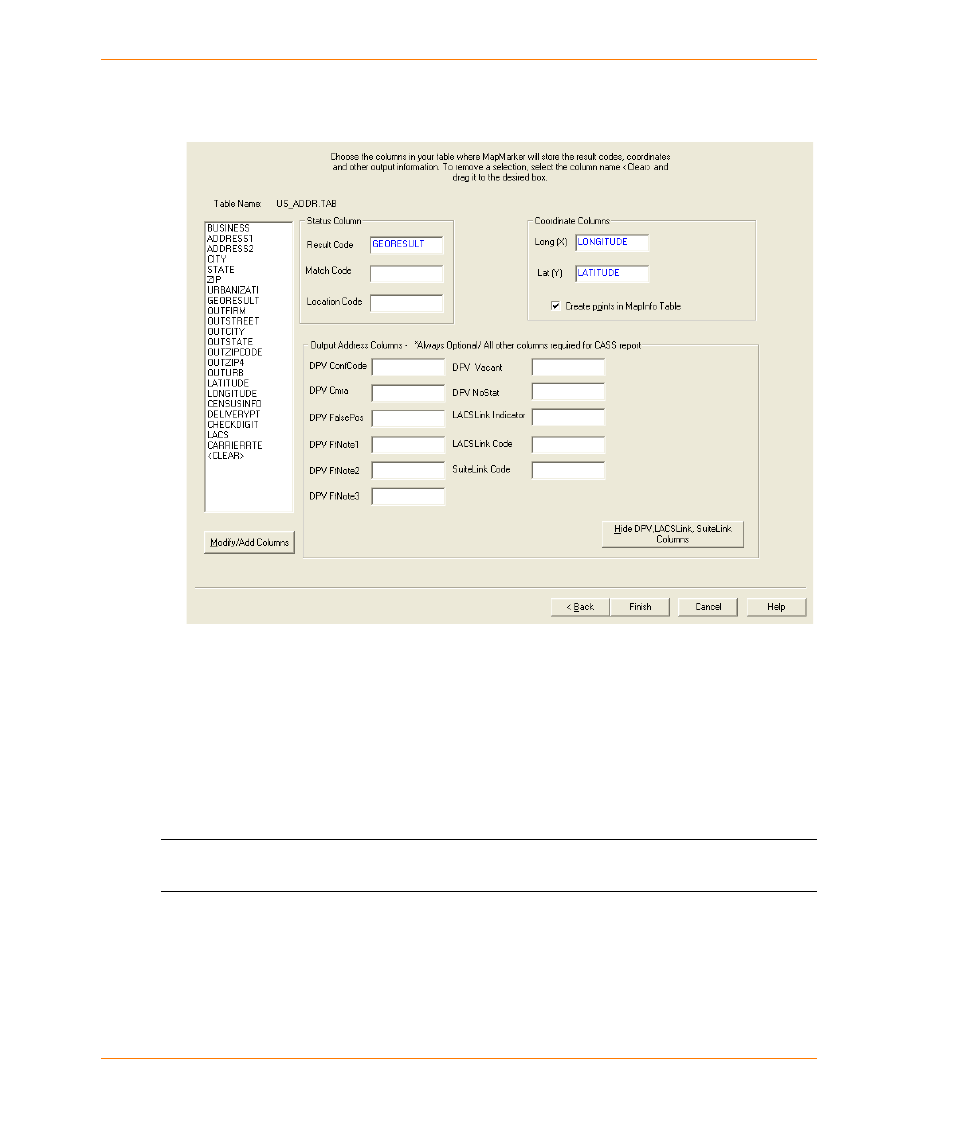
3. Open the table you want to geocode. Proceed through the Select Column dialogs. When
selecting output columns, make sure that you click Show DPV and LACSLink Columns. This
displays the CASS-related columns.
For details of the LACS
Link
Indicator and LACS
Link
Code columns, see
4. Once you have provided all the information in the Select output columns from your table, click
Finish. You are then returned to the Geocode dialog box.
5. Select the Match Settings tab. In that dialog click Use CASS Mode and in the CASS options
group click Use LACSLink.
6. Click Geocode to begin geocoding.
L
LACS
Link
processing does not require the creation of a CASS report. Output addresses are
still provided without a report being created.
LACS
Link
Output Columns
There are two LACS
Link
output columns that you can add to your table before you geocode, although
LACS
Link
processing still continues if you do not have the columns. These columns contain
information about the LACS
Link
output.