Making the most of interactive geocoding, Change matching conditions – Pitney Bowes MapMarker USA User Manual
Page 82
Geocoding Your Table Interactively
MapMarker USA 25
82
User Guide
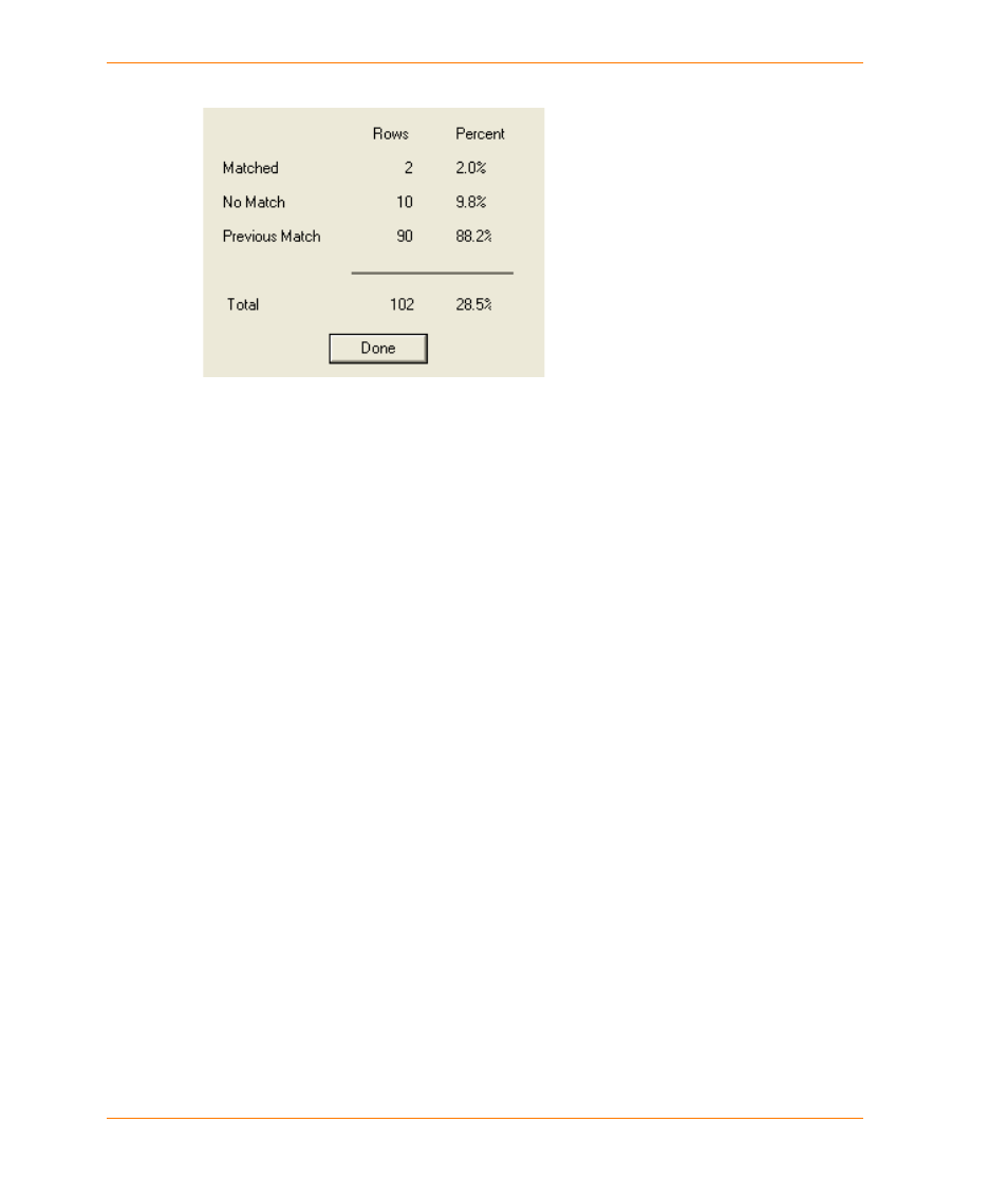
Click Close. A Geocoding Summary is displayed showing the results of the session
14. Click Done. To view the summary again, select View > Summary.
15. To create a summary of the geocoding results for a table, select Table > Table Summary.
Specify the column containing the georesult and save the information as a text file.
See the following topics:
Automatic Geocode dialog
Geocoding Your Table Automatically
Interactive Geocode dialog
Quick Geocode command)
Making the Most of Interactive Geocoding
Interactive geocoding allows you to control the matching process because you can accept or ignore
a potential match from the list of suggestions that MapMarker generates for the record.
See the following topics:
Change Matching Conditions on page 82
Map the Match Candidates on page 83
Change Matching Conditions
MapMarker follows the settings in the Geocode dialog or responds to your changed settings as you
progress through the interactive pass. To increase the list of suggested matches, you can use less
restrictive matching criteria. You can do this at the beginning of an interactive pass or change the
settings for each record by clicking Options on the
You can also return to a previous record in the table by selecting Back and changing settings as
needed. This feature can help you maximize the potential for a match.