Pitney Bowes MapMarker USA User Manual
Page 80
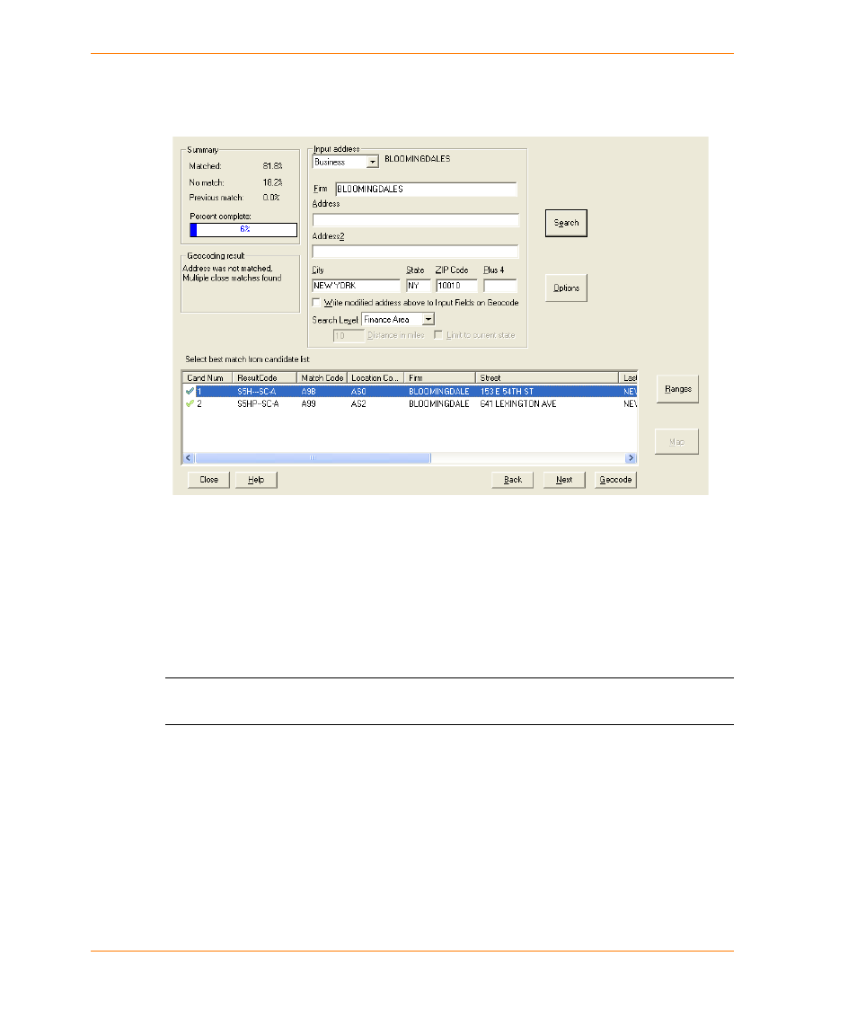
Geocoding Your Table Interactively
MapMarker USA 25
80
User Guide
3. Select the range and type of rows to geocode.
4. Click Geocode. The Interactive Geocode dialog appears and shows the first unmatched record
and a list of suggested matches.
The candidate list displays each potential match including a result code, Match Codes and
Location codes, street address, LastLine of address, and other information. A green check mark
in the Cand Num column indicates a close match. Use the horizontal scroll bar to see additional
columns, including the coordinates and the DataSource Name (the name of address or user
dictionary that returned the candidate.)
You can also right-click a candidate to a candidate and select Show Status Code Details. This
displays the Status Codes dialog with tabs for GeoResult Code, Match Code, and Locational
Code.
L
The candidate list columns are the same as you will see in the Quick Find dialog. See
Match Candidate List on page 159
for a more detailed description of these columns.
5. Select Geocode if you agree that the highlighted suggested match is the correct match.
MapMarker assigns coordinates from that row and moves on to display the next unmatched
record. To choose a different candidate in the list, move the highlight with your cursor to your
choice and select Geocode.