Add columns dialog – Pitney Bowes MapMarker USA User Manual
Page 222
MapMarker Dialogs
MapMarker USA 25
222
User Guide
The About MapMarker message box displays information about your copy of MapMarker, including
the version number, data vintages, and legal and licensing notices. Software and data expiration
information also appears (for example, the number of days remaining before your data expires).
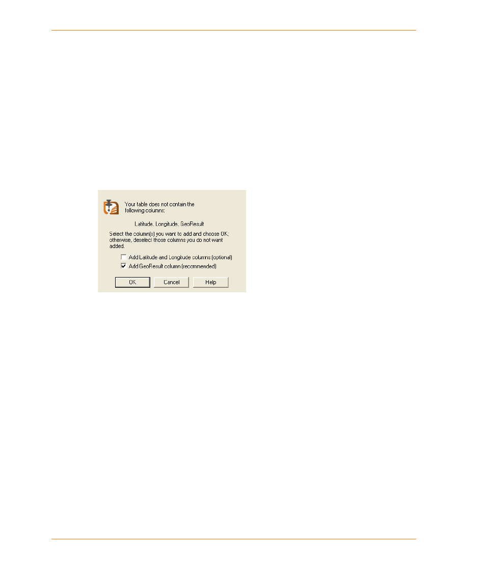
Add Columns dialog
The Add Columns dialog appears when you open a table within MapMarker that does not contain
one or more of the following columns: Latitude, Longitude, and GeoResult. This dialog prompts you
to select which columns to add to your table. Columns you select are added to your table when it
opens within MapMarker.
Tech
Support
Click to view technical support information.
Copyright
Click to view the product copyright
information.
Close
Click OK to close the dialog.
Add Latitude and
Longitude columns
(optional)
Click this check box to add latitude and longitude columns to your table.
Add Latitude column
Click this check box to add a latitude column to your table.
Add Longitude column Click this check box to add a longitude column to your table.
Add GeoResult
column
(recommended)
Click this check box to add a georesult column to your table.
OK
Invokes the settings and closes the dialog. The settings are saved in
the table’s metadata until you clear them.