Maps system preferences – Pitney Bowes MapMarker USA User Manual
Page 116
Maps System Preferences
MapMarker USA 25
116
User Guide
Maps System Preferences
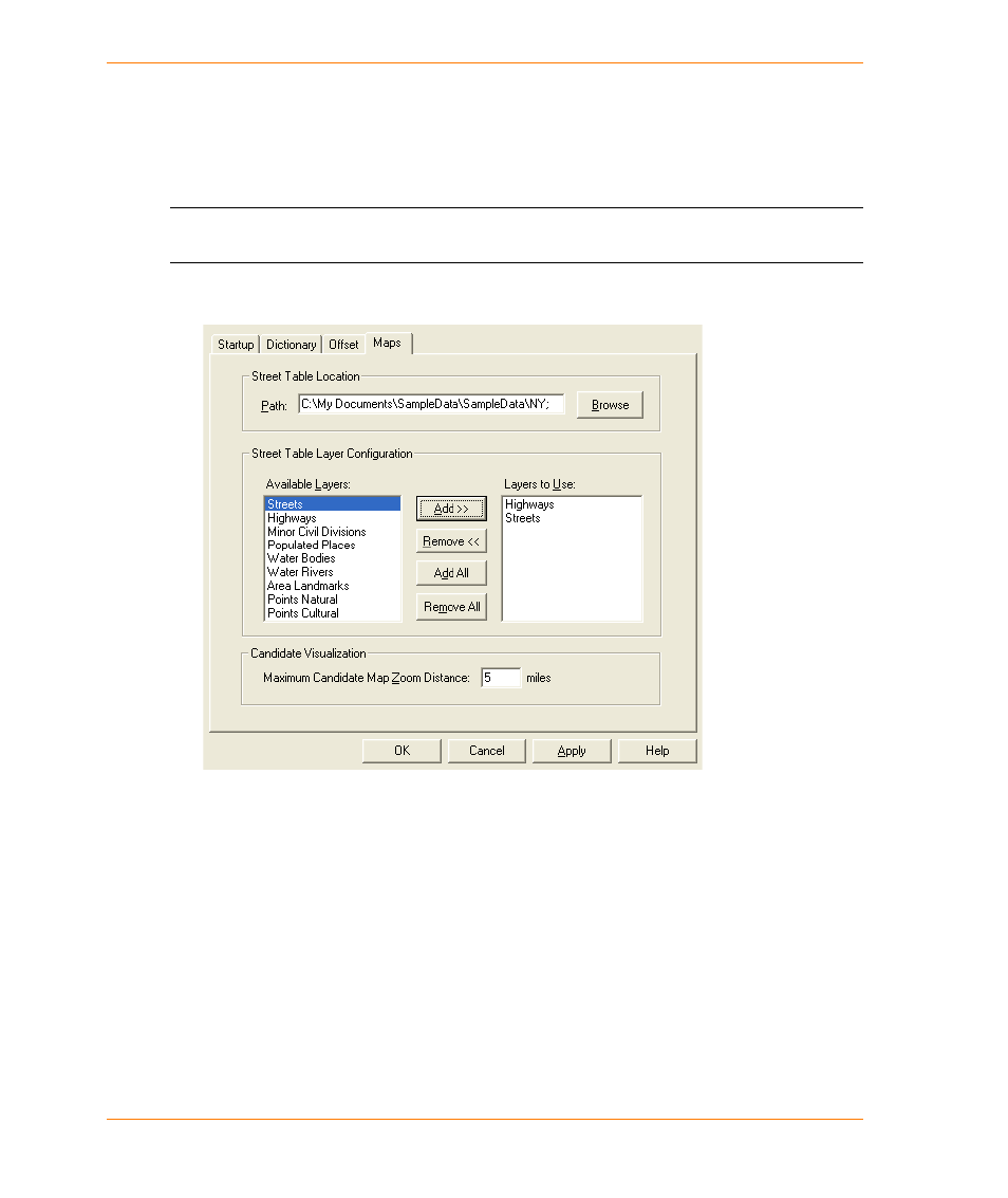
In order to display match candidates in a Map window from the Interactive or Quick Find dialog
boxes, MapMarker must know where the street data is located on your system. The Maps tab on the
System Preferences dialog allows you to set the directory path to the street data.
L
If you do not specify a valid location of the street data, the Map and Range buttons on the
Interactive or Quick Find dialog boxes will be disabled.
The Map System Preferences are displayed and selected as follows:
This also enables you to set an initial display radius for the Candidate Visualization Map window.
The radius is the distance in miles around the first match candidate that MapMarker finds among
multiple matches when you geocode interactively. Set this distance in the Maximum Candidate Map
Zoom Distance field. The default value is five miles. You can set the distance from 1–99 miles. Use
the zoom in and zoom out tools in the Candidate Visualization Map window to control the view of the
map, and choose how much data you want to view in the Map window.
For best results when geocoding with MapMarker, use MapMarker Streets or StreetPro Enhanced
as the background street map. These street packages are geographically consistent with the street
data in the MapMarker Address Dictionary.
For information on how to quickly visualize candidates on a map, see
. For information on visualizing candidates from the Quick Find dialog box, see