Spatial index types for spatialtype, Per-record styles, Symbol, pen, brush clause syntax – Pitney Bowes MapMarker USA User Manual
Page 290
Adding Rows to the MapInfo_MapCatalog
MapMarker USA 25
290
User Guide
Spatial Index Types for SPATIALTYPE
This table lists the supported Spatial Index types for SPATIALTYPE.
.
Per-Record Styles
Per-record style allows geometry in a single table to have its own style. For example, a single 'public
institution' table in Oracle Spatial can have schools, town halls, libraries, and police departments and
each point type would be represented with its own symbol (i.e., a school symbol for all the schools).
Similarly, a single road table in SpatialWare SQL Server may have different road types such that
streets are shown as a single pixel black line, secondary roads as a double pixel red line and
interstates as parallel red lines.
To use per-record styles, your table must be represented with an entry in the MapInfo Map Catalog
with appropriate settings for RENDITIONTYPE, RENDITIONCOLUMN, and RENDITIONTABLE.
L
If these columns are not present, the table’s default style will be applied to all objects.
Symbol, Pen, Brush Clause Syntax
If you are manually creating a MAPINFO_MAPCATALOG table to provide support for a remote
spatial database, you will need to specify a symbol style, and possibly line and fill styles as well.
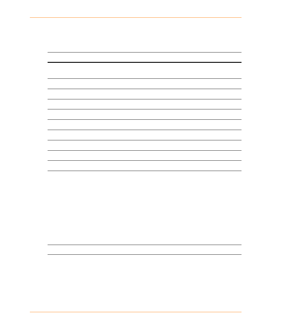
Spatial Index Types
Spatial Index Type
Type Number
MapInfo MICODE schema (any database) — Point layer in X/Y columns
indexed with micode (a serialized quadtree key)
1
XY schema (any database) — Point layer in X/Y columns
4
Oracle Spatial Geometry
13.x
SpatialWare for Microsoft SQL Server
14.x
Oracle Spatial Annotation Text
16.x
SQL Server Spatial (for geometry)
17.x
SQL Server Spatial (for geography)
18.x
PostGIS for PostgreSQL
19.x
SQL Server Spatial with M and Z values (for geometry)
20.x
SQL Server Spatial with M and Z values (for geography)
21.x