Maps preferences dialog – Pitney Bowes MapMarker USA User Manual
Page 247
Appendix A:
MapMarker Dialogs
MapMarker USA 25
247
User Guide
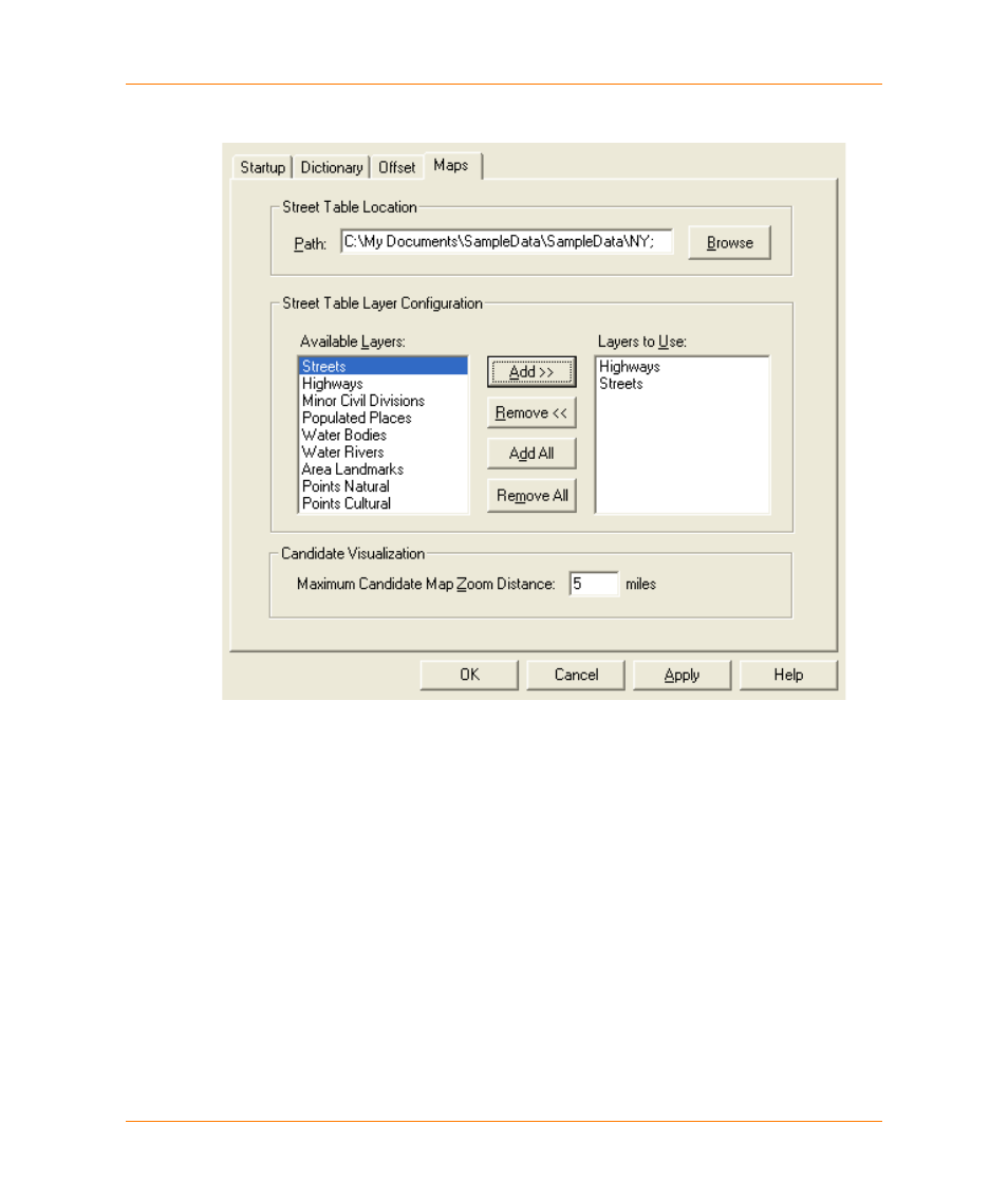
Maps Preferences dialog
To see the Maps Preferences dialog, select Options > System Preferences and select the Maps
tab. Use this dialog to set the location and layer choices of the street data to display in the Candidate
Map.
Street Table Data
Location
Specify the path for the MapMarker Streets, StreetInfo or StreetPro data
set. Click Browse to navigate to the location instead of typing it in. You do
not need to specify particular files to be opened.
Street Table Layer
Configuration
Choose the layers you want to see in the candidate map from the Available
Layers list.
Add
Adds any highlighted layer in the Available Layers list to the Layers to Use
list.
Remove
Removes any highlighted layer from the Layers to Use list.
Add All
Adds all layers from the Available Layers list to the Layers to Use list.