Selecting output columns – Pitney Bowes MapMarker USA User Manual
Page 75
Chapter 3:
Selecting Input and Output Address Columns
MapMarker USA 25
75
User Guide
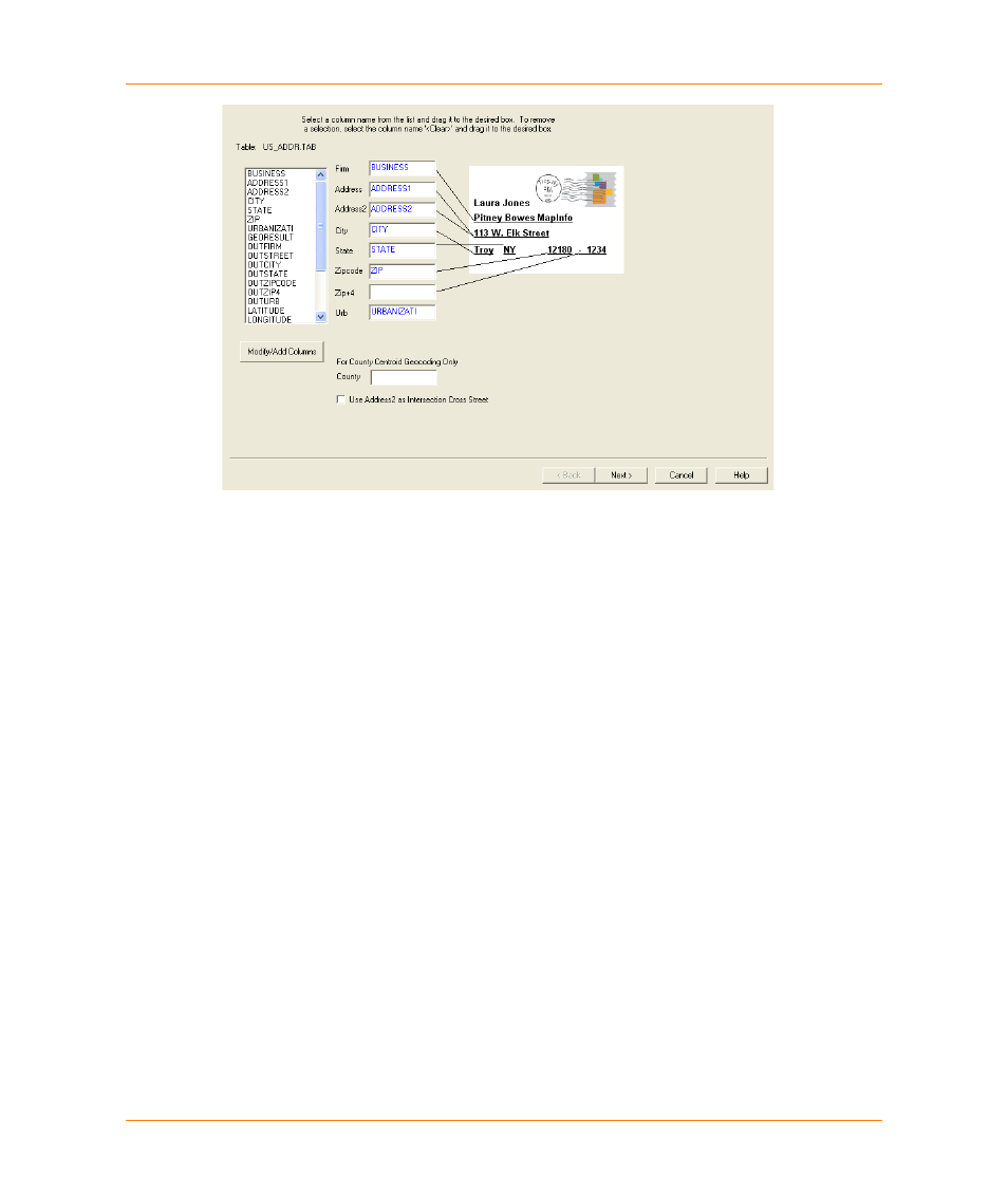
3. Select the input columns that contain the appropriate address components. If your table has
separate columns for ZIP Code™ and ZIP + 4
®
information, identify each column in the
ZIP Code and ZIP + 4 boxes.
MapMarker attempts to choose the address columns for you. It can make some determinations
for fields, but if this is the first time this table has been opened in MapMarker, be sure to verify
these columns. Once you have geocoded the table, the column settings are saved to the table as
metadata and used for future geocoding sessions.
Single line address
input is recognized in the Address field. See
Using Single Line Addresses in Geocoding on
for details on geocoding single line addresses.
County Level Geocoding
Use the County input field only if you want to explicitly geocode to the county centroid. You may
need to add the County column to your input table. (Click Modify/Add Columns and see
. For county centroid geocoding, you should also use the State
input field because identically named counties are found in several states.
4. When you are finished selecting input columns, click Next. You are now ready to select output
.
Selecting Output Columns
After you have selected input columns, you will see a dialog box titled: Select output columns from
your table.
1. Select columns in your output table where you want MapMarker to store the address
components, result codes, and coordinate information for each matched record. From the list of
at the left, drag column names to the appropriate output address column. Use
to clear a column selection.