Chart viewer airport information, Airport information – Jeppesen FliteDeck 3 User Manual
Page 68
FliteDeck Basics
71
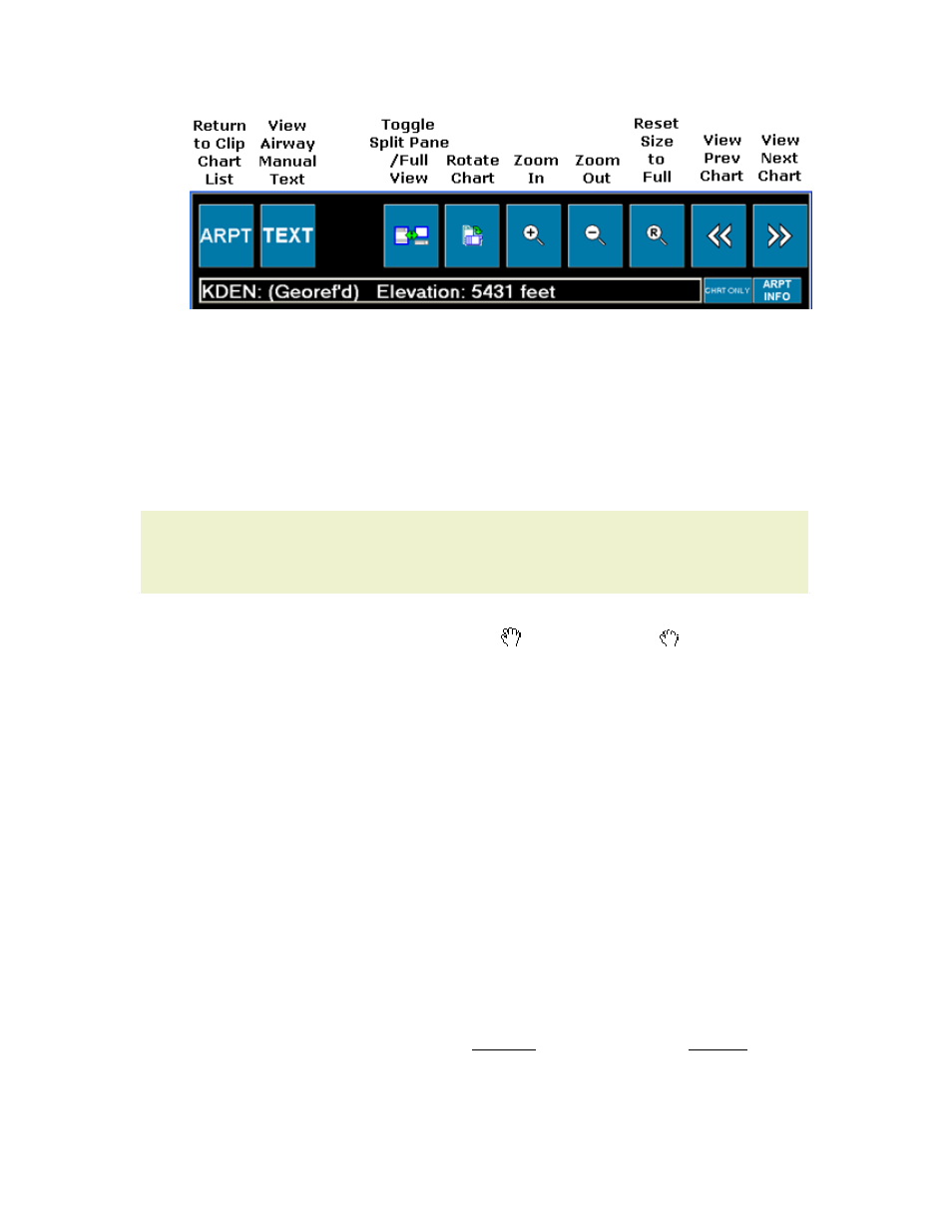
Below the navigation buttons:
• The chart title box displays the airport identifier, geo-reference status of the
chart (for enroute overlay and moving map), and airport elevation.
• The CHRT ONLY button hides and shows the
on the lower
right.
• The ARPT INFO button opens the
.
Other controls:
TIP
In the split pane view, click in the top pane to toggle between the full chart
and the plan view. Click in the lower pane to toggle between header,
profile, and minimums.
• Within the zoomed-in chart view, click and drag the mouse to pan the chart.
The cursor icon changes from an open to a closed hand when the pan
drag is available.
• View charts for this airport that are not on the clipboard by clicking the
on the right.
Return to the clipboard chart list by clicking the Back arrow, below ARPT INFO on
the right, or ARPT on the top left.
Chart Viewer Airport Information
The Airport Information page is separated into three sections: General,
Communication Frequencies, and Runways/Navigation Frequencies. To view
information, click on the labeled tab in the application.
• GENERAL information contains airport information about location, latitude
and longitude coordinates, elevation, time zone, fuel types and services.
Information for US airports includes the name of the paper sectional that
shows the airport.
• COMM FREQS displays communication frequencies for the selected airport.
• RWYS/NAV displays runway information including size, surface conditions,
touchdown zone elevation (TDZE), localizer ID, frequency and bearing. This
page also displays information for nearby navigational aids.
To move up and down within a page, click or tap on the up and down arrow buttons
at the top right.