Viewing airport information, Information, see, Airport information – Jeppesen FliteDeck 3 User Manual
Page 111
JeppView FliteDeck User's Guide
114
• nnn = waypoint identifier
• rrr = radial
• ddd = distance
Examples:
• UBG/110/10 = Newburg VOR, 110-degree radial, 10 nm.
• PDX/160/20 = Portland VOR, 160-degree radial, 20 nm.
In the second example, PDX matches both Portland (Oregon) International Airport
and Portland VOR. When an identifier matches more than one waypoint, click the
Choose Waypoint button to select which you would like to use. See
for a similar procedure.
TIP
If you are using a pointing device, you can also click/touch on the enroute
chart and the Enter Waypoint text box automatically enters the
information. If it did not enter what you wanted, zoom in closer and try
again.
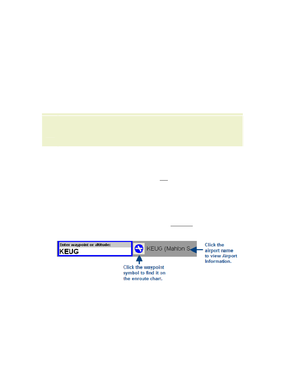
Viewing Airport Information
You can view general airport information for both IFR and VFR airports (runway
information, communication and navigation frequencies) by clicking the Info:
[Airport] button on the Plan page, Terminal page, Enroute Nav page and Enroute
Map page. If you have a connection to XM weather, additional weather information
also displays, such as TFRs, METARs, Terminal Area Forecasts and City Forecasts
(see
for additional information).
To view the airport information:
• On the Plan page, enter an airport in the Enter Waypoint text box, and click
Info: [Airport] or click the airport name to the right of the Enter Waypoint
Text Box.
• On the Terminal page, click Info: Airport.
• On the Enroute Nav page, click on an airport in the enroute chart and click
Info: [Airport].
• On the Enroute Map page, click on an airport in the enroute chart and click
Info: [Airport].