City forecast, City, Forecast – Jeppesen FliteDeck 3 User Manual
Page 221
JeppView FliteDeck User's Guide
224
3. Click Weather; the TAF follows the METAR.
• On the Terminal Chart page:
for information about
selecting airports).
1. After an airport terminal chart is displayed, click INFO: [Airport ID].
2. Click Weather; the TAF follows the METAR.
• On the Enroute Nav page:
0. With a pointing device, click on an airport in the enroute chart.
NOTE
If you click on the airport, the name and the identifier appear in
the status bar. If you see something other than the airport, such
as latitude/longitude coordinates or an intersection, zoom in
closer and try again.
2. Click INFO: [Airport ID].
3. Click Weather; the TAF follows the METAR.
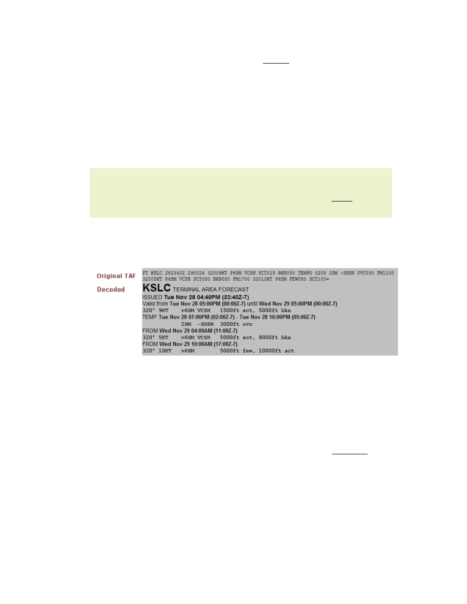
FliteDeck displays the coded and plain language TAF.
City Forecast
City forecasts show current and forecasted conditions in available cities.
Data Broadcast Frequency: 12 minutes
To view a city forecast, use one of the following techniques:
• On the Plan page:
1. Enter the airport identifier or the name into the Enter Waypoint text
box (see
for additional information).
2. Click INFO: [Airport ID].
3. Click Weather; the city forecast follows the TAF.
• On the Terminal Chart page:
for information about
selecting airports).
2. After an airport chart is displayed, click INFO: [Airport ID].