Reviewing metar text information – Jeppesen FliteDeck 3 User Manual
Page 216
Satellite Weather
219
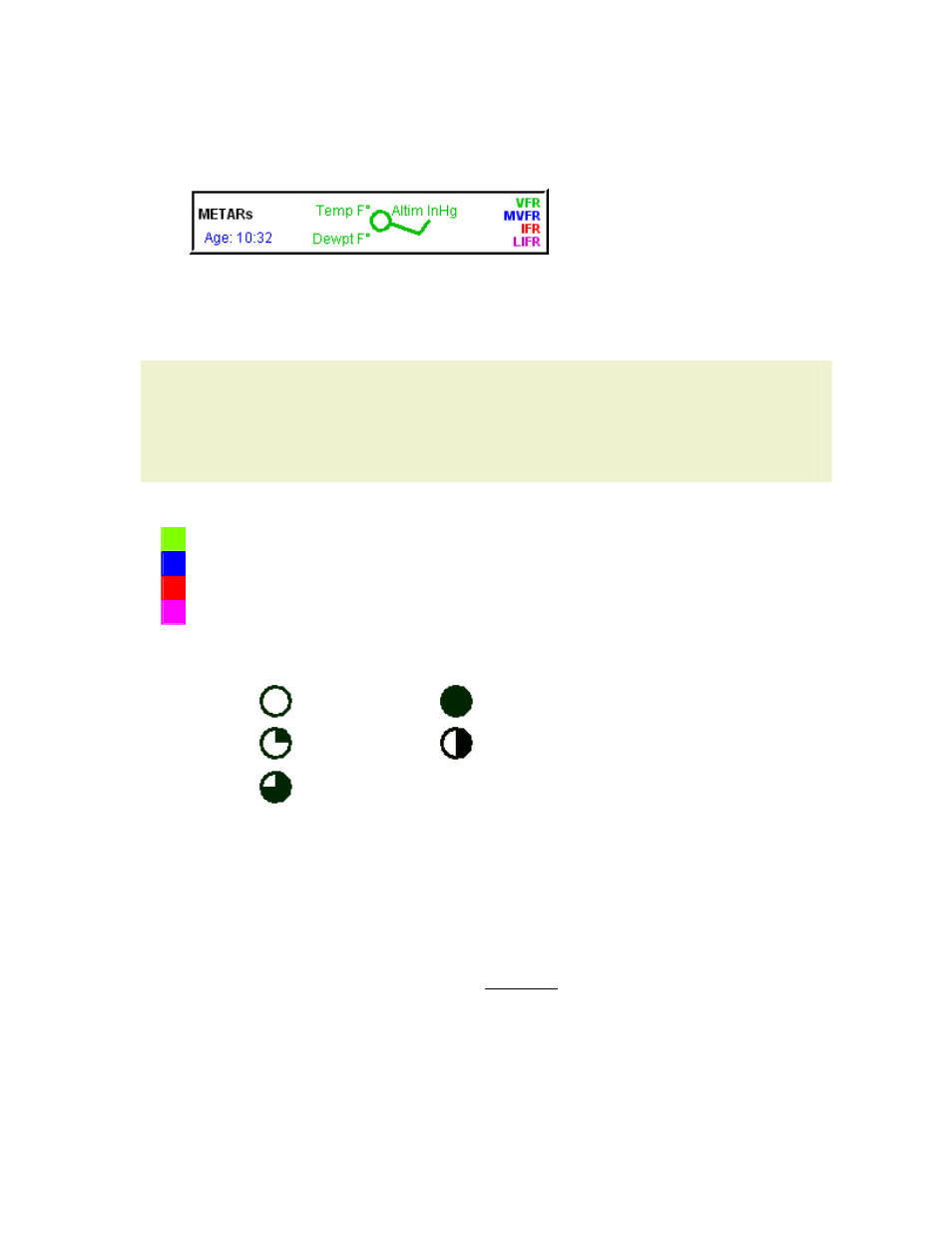
for additional information). On the legend, there
is a counter displaying the age of the data in minutes (lower left, in blue).
Data Broadcast Frequency: 12 minutes
• Temperature is shown in degrees Fahrenheit.
• Dewpoint is shown in degrees Fahrenheit.
• Altimeter Setting is shown in inches of mercury.
TIP
The simple conversion formulas from Celsius (C) to Fahrenheit (F), and for
the conversion of F back to C are as follows:
• F = 1.8*C + 32
• C = (F - 32)/1.8
The following list shows the minimums and color associations:
VFR
Visibility > = 3 AND Cloud Ceiling > = 1500 (ft AGL)
MVFR Visibility > = 2 AND Cloud Ceiling > = 1000 (ft AGL)
IFR
Visibility > =1 AND Cloud Ceiling > = 300 (ft AGL)
LIFR
Visibility < 1 OR Cloud Ceiling < 300 (ft AGL)
The METAR symbols are similar to what is used in aviation weather depiction charts.
The areas depicted in black are shaded with the colors associated with above.
Clear Sky
Overcast
Few
Scattered
Broken
Reviewing METAR Text Information
The Airport Information window contains specific information about the METAR
reports. To gain information about a METAR at an airport, use one of the following
techniques:
• On the Plan page:
1. Enter the airport in the Enter Waypoint text box (see
for additional information).
2. Click INFO: [Airport ID].
3. Click Weather; the METAR information is at the top of the page.
• On the Terminal Chart page: