Legend and age of data, Wind data in the profile view, Surface analysis – Jeppesen FliteDeck 3 User Manual
Page 226: Knots (see
Satellite Weather
229
The wind altitude seen on the enroute chart and terminal chart is dictated from the
altitude of the GPS input or the altitude set within the GPS simulator (see
FliteDeck with the GPS Simulator Trainer
). If a GPS is not available or FliteDeck is
configured to be a terminal chart viewer only, you can display wind information at a
specific altitude by doing the following:
1. Click the Plan tab.
2. In the Enter Waypoint text box, enter the desired altitude to view wind
information (8500, FL120). With the flight level format, do not place any
spaces between FL and the value.
3. Click Cleared to [altitude] ft/m.
The altitude entered displays on the legend. Selecting a route does not change the
altitude of the winds. If you need to see winds at a different altitude, you must
repeat the steps outlined above. When positional data is present using a GPS or the
GPS simulator, the altitude of the wind data shown uses the present position altitude
and ignores the manual altitude set with the Cleared to [altitude] ft/m button.
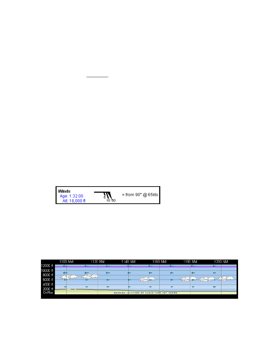
Legend and Age of Data
To view the age of the data, click Wx on any of the pages (except the Text page and
the Terminal page does not display legend information) until the Winds legend
appears (see
for additional information). On the legend there
is a counter displaying the age of the data and the altitude that winds are being
displayed.
Data Broadcast Frequency: 12 minutes
Wind Data in the Profile View
In the Profile View, winds are displayed as blue arrows at different altitudes. The
arrow length indicates the relative strength of the wind component. The longer the
arrow the faster the wind speed. Weather symbols are always displayed in the Profile
View as long as the wind data is being received from your weather receiver. At this
time, an option to hide the information is not available. See
additional information.
Surface Analysis