Spectra Precision Survey Pro v4.6 Recon and Nomad User Manual User Manual
Page 248
User’s Manual – GPS Mode
238
E
lli
ps
oi
d
Mapping Plane
K=0.9996
K=1.0
K=1.0
Central Meridian
K>1.0
K>1.0
K<1.0
Distance on Ellipsoid
Distance on Map
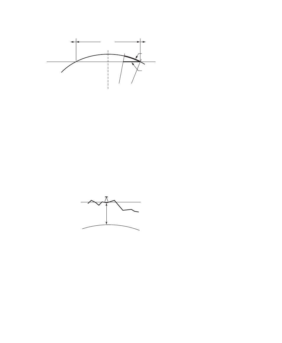
• Universal Transverse Mercator Projection
The scale factor at the central meridian (CM) is 0.9996. The scale
factor is 1.0 approximately 170-km east and west of the CM. The
scale factor is less than one between the CM and the point of
tangency. The scale factor is greater than one beyond the point of
tangency. Therefore, at the central meridian, a geodetic distance of
100m scales into a mapping plane distance of 99.96m.
Ellipsoid
Terrain
h
Mapping
Plane
• TDS Localization Stereographic Projection
The scale factor at the start location (usually the first GPS base
station in a project) is calculated for ground distances at the base
height. The scale factor increases more or less uniformly in all
directions as you move away from the base. The scale factor does not
Fig. 4: Localization Stereographic Mapping Plane
A side view of the ellipsoid and stereographic mapping
plane show the scale calculated for ground distances at
the base height.
Fig. 3: Transverse Mercator Mapping Plane
A side view of the cylinder shows the effect of scale
distortion.