Chapter 8: maps, Work with the map module, View photos on a map – Adobe Photoshop Lightroom CC User Manual
Page 112: Navigate the map
107
Last updated 4/20/2015
Chapter 8: Maps
Work with the Map module
View photos on a map
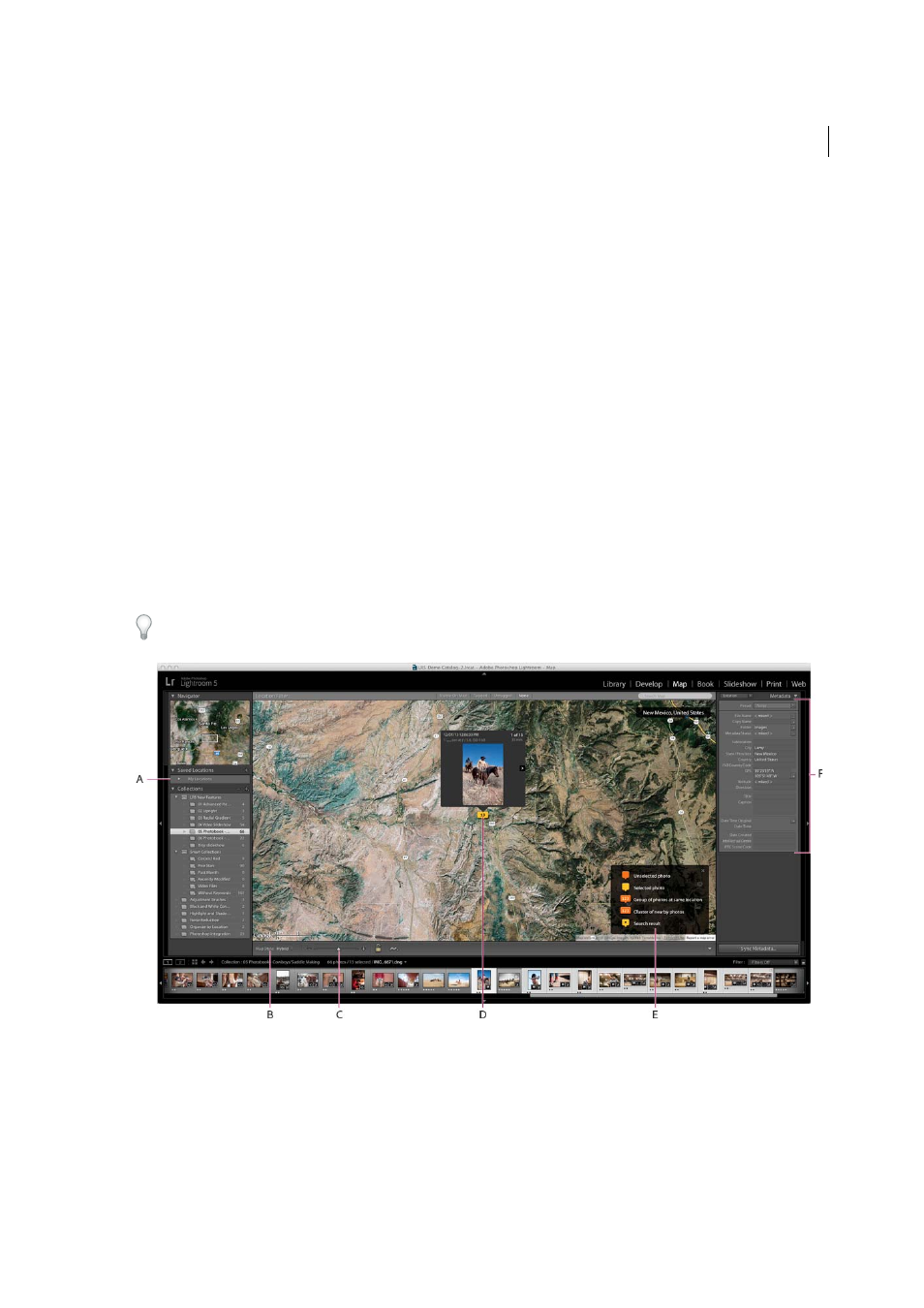
The Map module lets you see where your photos were captured on a Google map. It uses GPS coordinates embedded
in your photos’ metadata to plot the photos on the map.
Most mobile phone cameras, including iPhones, record GPS coordinates in metadata. If your camera doesn’t record
GPS coordinates you can add it in the Map module, or import a track log from a GPS device.
You must be online to use the Map module. Maps appear in the language that your default web browser uses, which
may be different from the language version of Lightroom that you’re using.
To see if a photo is tagged with GPS metadata, choose the Location preset in the Metadata panel of the Library or Map
module. Then, look for coordinates in the GPS field.
A Saved Locations panel B Map Style menu C Zoom slider D Selected photo E Map key F Metadata panel
Navigate the map
To navigate the map in the Map module, do any of the following:
• Double-click the map to zoom in to that location.
• Drag the Zoom slider in the toolbar to zoom in or out.