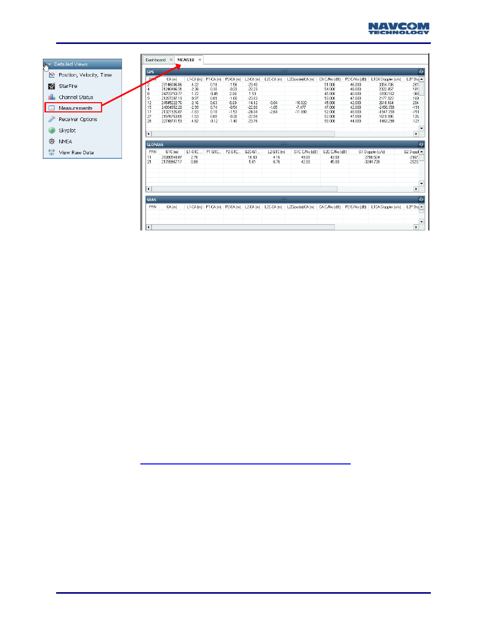
Description of data, Gps/sbas, Figure 144: meas1b tab – NavCom StarUtil-3000 Rev.G User Manual
Page 154: Figure 144)
StarUtil 3000 User Guide
– Rev G
9-152
Figure
144
: MEAS1B Tab
Description of Data
Doppler consists of the coarse Doppler from the satellite block adjusted by the delta
Doppler in each of the associated signal blocks. To generate the true Doppler, add
the coarse Doppler to the delta Doppler. Refer to the Sapphire Technical Reference
manual (see Related Documents in the fore-matter).
GPS/SBAS
PRN: The satellite number assigned to each channel.
GPS: The valid range is 1-32. (The receiver allocates the range of 1-37, with 33-37
reserved for expansion.)
SBAS: The valid range is 120-138.
Normally, the SF-3050 receiver locates and tracks SBAS satellites at run-time,
periodically building a list of the satellites that will contribute to the navigation
solution.
However, a user can create a fixed list of SBAS satellites to track. Creating a list that does
not contain any visible satellites disables the use of SBAS corrections in the navigation
solution. Refer to
Manual Selection of SBAS PRN via the Input Terminal
instructions on how to manually select the SBAS PRN.
CA (m): Coarse / Acquisition code. The number of meters (range measurement) to the
satellite.
L1-CA (m): The L1 frequency minus the CA measurement.
P1-CA (m): The P1 pseudorange minus the CA measurement.
P2-CA (m): The P2 pseudorange minus the CA measurement.
L2-CA (m): The L2 frequency minus the CA measurement.
L2C-CA (m): The L2C frequency minus the CA measurement.