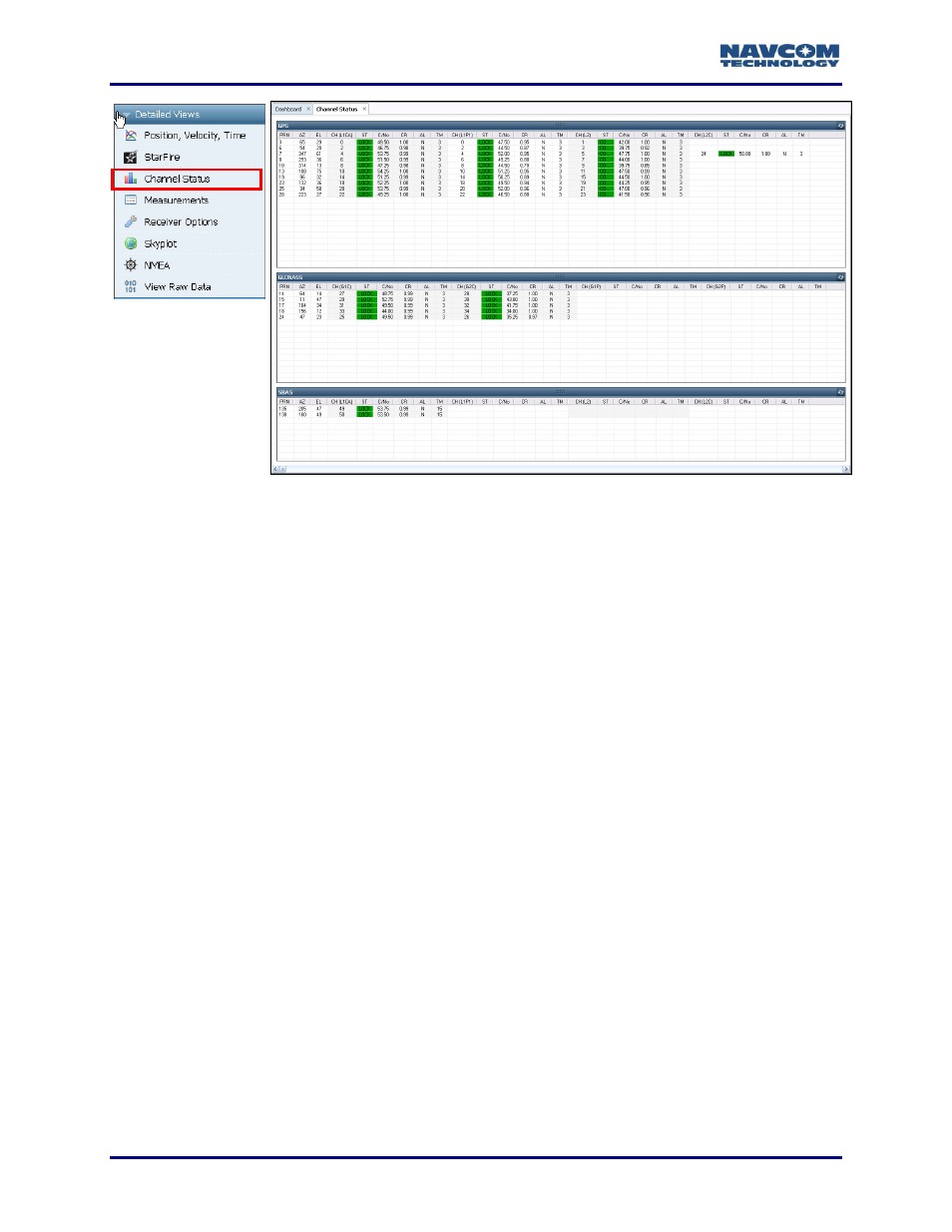
Description of data, Figure 143: channel status tab – NavCom StarUtil-3000 Rev.G User Manual
Page 152
StarUtil 3000 User Guide
– Rev G
9-150
Figure
143
: Channel Status Tab
Description of Data
The data below is displayed for each channel on the GPS, GLONASS, and SBAS windows.
Differences between the constellations are identified.
PRN: The satellite number assigned to each channel.
GPS: The valid range is 1-32. (The receiver allocates the range of 1-37, with 33-37 reserved
for expansion.)
GLONASS: The valid range is 1-24.
SBAS: The valid range is 120-138.
Normally, the SF-3050 receiver locates and tracks SBAS satellites at run-time,
periodically building a list of the satellites that will contribute to the navigation
solution. However, a user can create a fixed list of SBAS satellites to track. Refer to
Manual Selection of SBAS PRN via the Input Terminal in this manual.
Creating a list that does not contain any visible satellites disables the use of the
SBAS corrections in the navigation solution.
AZ: Azimuth. The horizontal angle of the satellite relative to the receiver position in
reference to North ranging from 0 (360) to 359 degrees.+
EL: Elevation. The vertical angle of the satellite off the horizon ranging from 0 degrees to a
zenith of 90 degrees.
CH (Code Type): The channel number of the receiver, within a range of 0
– 53. The code
types tracked by the channel are:
GPS: L1CA, L1P1, L2, L2C, and L5 based on the [TRACKINGMODE] command settings
GLONASS: G1C, G2C, G1P, and G2P based on the [TRACKINGMODE] command
settings
SBAS: L1CA (These code types are displayed,
but don’t apply: L1P1, L2, L2C, and L5.)