Velocity & headings, Sky plot, Starfire – NavCom StarUtil-3000 Rev.G User Manual
Page 144: Figure 133: dashboard

StarUtil 3000 User Guide
– Rev G
9-142
PVT
Provides a quick view of the current position.
DATUM: Displays the selected reference model. Also displays the current Geoid Model
loaded in the receiver, GGM02 or GEOID99, or No Geoid Model. Refer to
If No Geoid Model is displayed, the Height and Altitude are the same. If the GGM02
database is loaded, the Height and Altitude typically differ.
The menu option for this window
switches the view to the PVT
(Position, Velocity, and Time) tab.
Velocity & Headings
The speed over ground and direction of travel (true, not magnetic). The Velocity and
Heading displays do not provide a reading until the speed over ground is
½ meter/second.
Neither needle moves at speeds less than this value to reduce screen clutter. Refer also to
the
The menu option for this window
switches the view to the PVT tab.
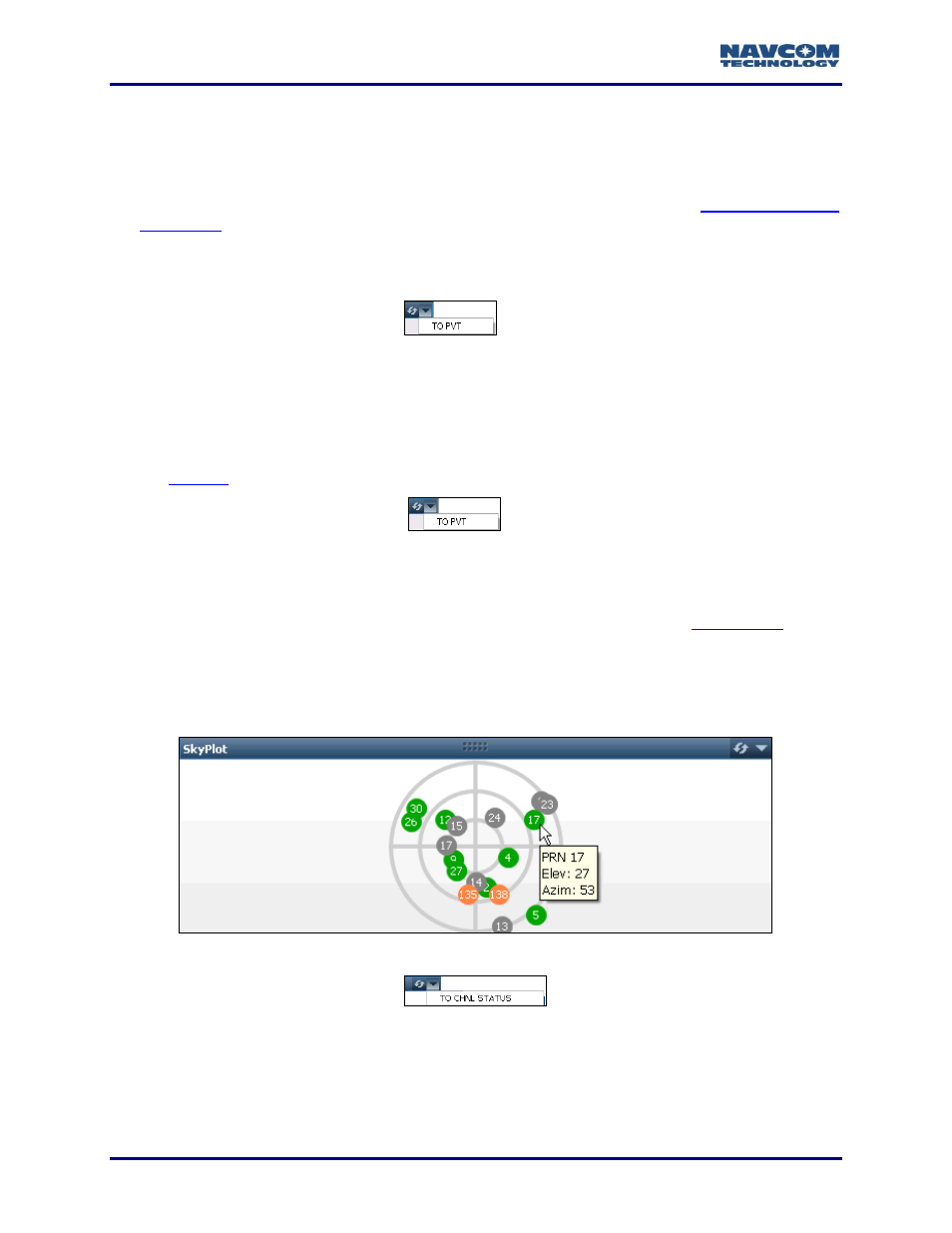
Sky Plot
Refer to Figure 133.
Displays the tracked satellite locations for each visible constellation. The
provides an interface to select the constellations to be displayed. Each satellite is displayed
on the Sky Plot by color and PRN: GPS = Green. GLONASS = Grey. SBAS = Orange.
Roll over a satellite (colored circle) to view a pop-up window with its PRN, Elevation, and
Azimuth.
Figure
133
: Dashboard
– Sky Plot
The menu option for this window
switches the view to the
Channel Status tab.
StarFire
The StarFire map displays an estimate of the coverage area of the current StarFire satellites
under track.
