3 point management – Leica Geosystems GPS System 500 - Technical Reference Manual User Manual
Page 284
284
11. Applications
Technical Reference Manual-4.0.0en
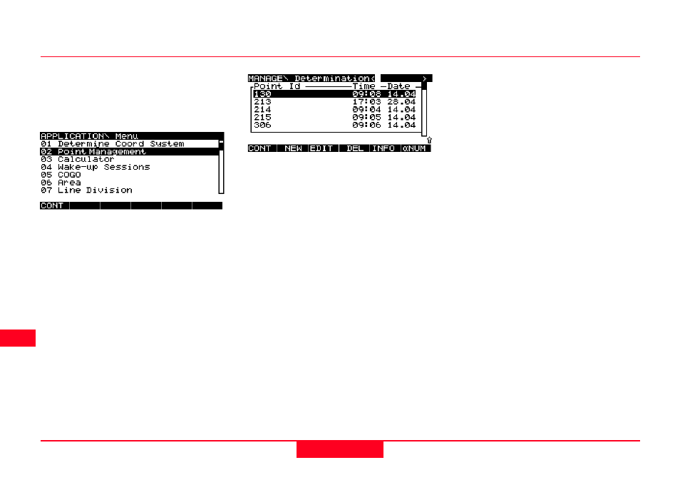
Enables you to manage the points
contained in the currently selected
Job. You may also set a point filter
according to varying criteria.
Select Point Management and press
CONT (F1).
11.3 Point
Management
Each point is displayed with the time
and date on which it was recorded.
Note that automatically recorded
points will only be displayed if Store
Pt Db is set to YES in the
CONFIGURE\ Position Logging panel
(see chapter 5.4 for details).
Coordinates for the same point
recorded on different datums are
displayed separately. Each point is
displayed with its highest Point Class
only.
Press INFO (F5) to reveal the Crd
Source - the source from which the
coordinates were generated.
Calculated - calculated (WGS84)
from other sets of coordinates.
Calc (Grid) - calculated (Grid) from
other sets of Coordinates. E.g. via
COGO routines.
GPS Navigtd - GPS navigated
position.
PPRC Code - Post processed GPS
code only.
PPRC flt ph - Post processed GPS
phase float position (ambiguities not
resolved).
PPRC fix ph - Post processed GPS
phase. Ambiguities fixed.
RTME Code - Real Time GPS
position code only.
RTME fix ph - Real-Time GPS phase
position. Ambiguities fixed.
GPS RTCM - Real Time GPS posi-
tion from RTCM code corrections.
Unknown - Unknown source.
User enterd - WGS84-coordinate
entered by user.
User (Grid) - Grid coordinates
entered by user.