4 orientation – Leica Geosystems GPS System 500 - Technical Reference Manual User Manual
Page 211
211
7. Measuring with System 500
Technical Reference Manual-4.0.0en
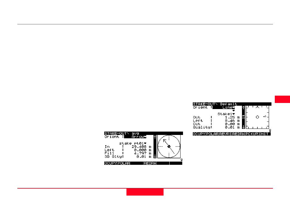
The Orientation defines a reference
direction from which all
measurements to target points are
made.
The orientation is defined by a point
or a line.
To select a method of Orientation,
highlight the Orient field and use the
left or right cursor keys to cycle
through the options or press Enter to
open a window containing all the
options.
North - The reference direction from
which all measurements are
displayed to Target points is north in
the active coordinate system.
Sun - The reference direction from
which all measurements are
displayed to Target points is the sun.
The Receiver contains an almanac
and can calculate the position of the
sun irrespective of local time or
position.
7.5.4 Orientation
Last Pt - The reference direction
from which all measurements are
displayed to Target points is the Last
Point that was recorded.
Known Pt - The reference direction
from which all measurements are
displayed to Target points is a point
contained within the current “Stake
from” Job. Select the point from the
list that is presented when this option
is chosen.
Arrow - If Arrow has been selected
the graphical display will show a
moving arrow pointing in the direction
of the point to be staked.
Line - The reference direction is
parallel to the selected line. Lines
may be defined based on points in
the Job.
Defining a new Line for Orientation
A new line for orientation may be
defined between any two points that
exist in the current Job used.
In the Orient field selected Line.
A new entry field will appear below
Orient. This field will be empty if no
lines are defined. Move to this field
and press ENTER to access the line
list box.