Leica Geosystems GPS System 500 - Technical Reference Manual User Manual
Page 225
225
7. Measuring with System 500
Technical Reference Manual-4.0.0en
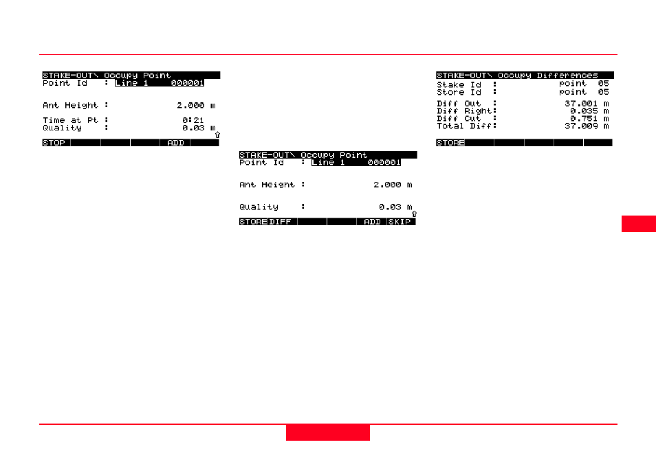
A default Point Id is suggested. This
comprises of the Line Id followed by
any incrementing numbers that you
have defined in the Occupy template.
Alternatively, you may press SHIFT
and then PT ID (F3) to use the Point
ID currently defined in the Occupy
template.
If you simply wish to add aditional text
to the suggested point Id, press
Enter. The point Id in the display
remains and the cursor will be in the
position defined in the current Point Id
template.
You may also enter a completely
different Point Id if required.
Press STOP (F1).
If a codelist has been defined you
may select a code. Details on adding
codes are given in section 7.4.4.
The DIFF (F2) key is available.
Pressing this key gives the differ-
ences between the startpoint of the
line and the staked point.
Diff In/Out - Horizontal distance In/
Out to the startpoint
Diff Left/Right - Horizontal distance
Left/Right to the startpoint.
Diff Cut/Fill - Vertical distance to the
startpoint of line.
Total Diff - Length of vector from
startpoint to measured point.
If you have chosen to record a LONG
log file these values will also be
stored in the log file.
Press STORE (F1) to store the point.