Projection – Pitney Bowes MapXtreme User Manual
Page 566
Appendix H: Elements of a Coordinate System
Projections and Their Parameters
MapXtreme v7.1
573
Developer Guide
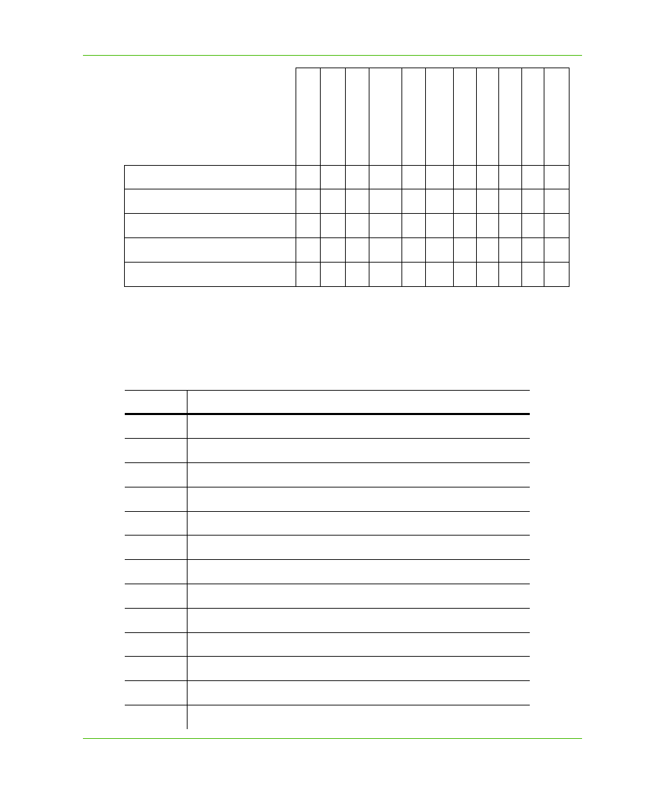
Projection
The projection is the equation or equations used by a coordinate system. The following list names
the projections MapInfo uses and gives the number used to identify the projection in the
MapInfoCoordinateSystemSet.xml file:
Robinson
X
X
X
Sinusoidal
X
X
X
Stereographic
X
X
X
X
X
X
X
Swiss Oblique Mercator
X
X
X
X
X
X
Transverse Mercator
X
X
X
X
X
X
X
Datum
Unit
s
Orig
in, L
ong
itu
de
O
rigin, Latitude
S
tand
ard Parall
el 1
S
tand
ard Parall
el 2
Az
im
uth
Sc
al
e F
a
ct
or
False E
a
sting
Fal
se North
ing
Rang
e
Number
Projection
9
Albers Equal-Area Conic
28
Azimuthal Equidistant (all origin latitudes)
5
Azimuthal Equidistant (polar aspect only)
30
Cassini-Soldner
2
Cylindrical Equal-Area
31
Double Stereographic
14
Eckert IV
15
Eckert VI
6
Equidistant Conic, also known as Simple Conic
17
Gall
7
Hotine Oblique Mercator
4
Lambert Azimuthal Equal-Area (polar aspect only)
29
Lambert Azimuthal Equal-Area