Defining the mapinfo codespace – Pitney Bowes MapXtreme User Manual
Page 559
Appendix G: Defining the MapInfo Codespace
Defining the MapInfo Codespace
MapXtreme v7.1
566
Developer Guide
Defining the MapInfo Codespace
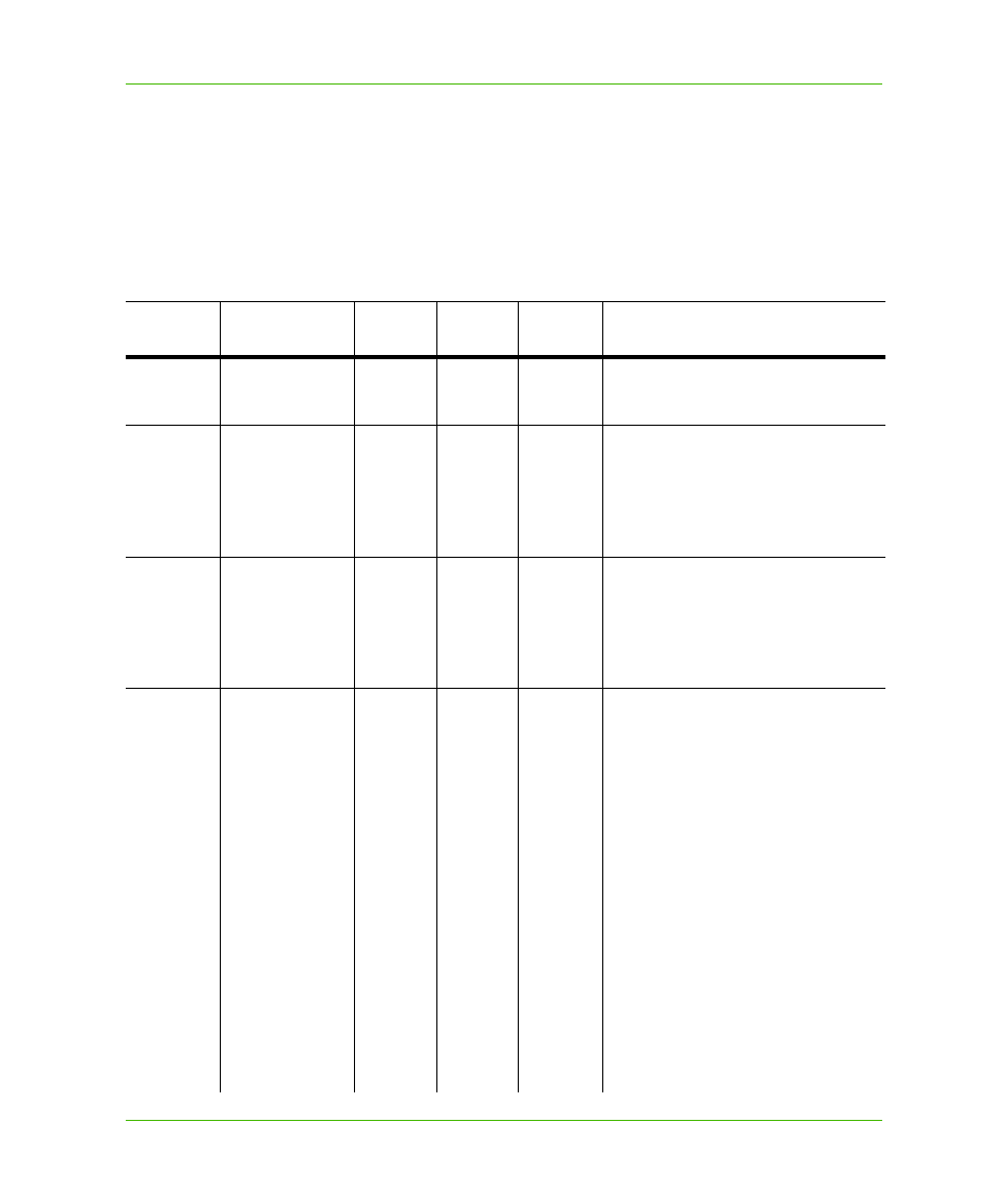
In the following table, we show the current MapInfo Codespace. These definitions will allow your
XML-based map documents to use our codespace and refer to common values, such as srsName.
An example of a point geometry definition, for example, could look like this:
MapInfo Codespace Definition
Category
Position 1
Position
2
Position
3
Position
4
Explanation and Example
coordsys
CoordSys file
*
A coordinate reference system.
Example: mapinfo:coordsys 1,74
pen
[1-255]
Simple Mapinfo pen pattern;
numbering [1-255] based on default
MapInfo MapInfow.pen definitions.
Follows all established rules.
Example: mapinfo:pen 46
brush
[1-8, 12-175]
Simple Mapinfo brush pattern number
[1-8, 12-175]. (Note: 9-11 are
reserved.) Based on default MapInfo
bitmap definitions.
Example: mapinfo:brush 17
length
in | ft | yd | mi
mm | cm | m | km
|
sft | nmi | li | ch |
rd | pt | twip | pica
| deg
pt= 1/72 in
pica = 12 pt
twip = 1/20 pt
1 deg = (pi/180) *
6370997 meter =
69.09329 mi
(based on great
circle)
Unit of length.
Supports inch | foot | yard | mile |
and
millimeter | centimeter | meter |
kilometer |
and
survey foot | nautical mile |
and
link | chain | rod | point | twip | pica |
degree.
Examples:
mapinfo:length m
mapinfo:length pt
mapinfo:length deg