Pitney Bowes MapXtreme User Manual
Page 233
Chapter 11: Accessing Data from a DBMS
Adding Rows to the MapInfo_MapCatalog
MapXtreme v7.1
240
Developer Guide
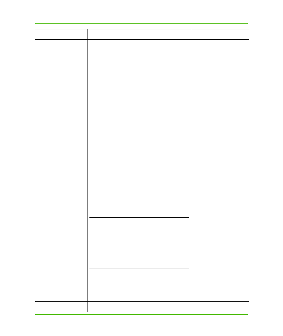
Column Name
Values to Assign
Examples
SPATIALTYPE
MapInfo Spatial Object Format
1: Point layer in X/Y columns indexed
with micode (a serialized quadtree key)
4: Point layer in X/Y columns
5
.
x: SpatialWare for Oracle
6
.
x: Ingres SQL - Not Supported
7
.
x: Sybase SQS - Not Supported
8
.
x: Oracle SDO version 2 - Not Supported
9.x: MapInfo Geocoding DataBlade
SpatialWare Point Module
10.x: MapInfo Geocoding DataBlade XY Module
11.x: SpatialWare IDS/UDO datablade
13.x: Oracle Spatial
14.x: SpatialWare for Microsoft SQL Server
17.x:SQL Server 2008 GEOMETRY without M
and Z values
18.X: SQL Server 2008 GEOGRAPHY without M
and Z values
20.x: SQL Server 2008 GEOMETRY with M and
Z values
21.x: SQL Server 2008 GEOGRAPHY with M
and Z values
Spatial Object Type
x.0: Points only
x.1: Lines only
x.2: Regions only
x.3: All types supported
L
This column describes the Spatial Object
Format of how the data is stored and
indexed and the Spatial Object type(s)
supported and not supported in the column.
The digits to the left of the decimal point are
the Spatial Object Format. The digits to the
right represent the type of Spatial Object
Type that can be stored in the column
Maps to
MapInfo.GeometryColumn.PredominantGeometry
Type, and
Has
14.0 = SQL Server
14.1
14.2
14.3
TABLENAME
The name of the table.
STATES