Throughput, Base satellites, Base location – Ag Leader ParaDyme Operation Guide User Manual
Page 44: Throughput base satellites base location
42
Ag Leader Integra and Versa Firmware Version 4.3 / Edge Firmware Version 5.1
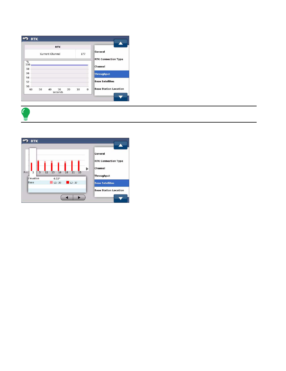
Throughput
The Throughput screen shows radio data that is saved
into the database. This data is used for diagnostic and
troubleshooting purposes. The Current Channel
indicates the channel associated with the data.
Note:
If a “Base not activated” message appears, contact your dealer for a feature code to “unlock”
the Base Station.
Base Satellites
The Base Satellites screen shows the current tracked
satellites from the Base Station. the screen is
refreshed every second. Use the Left or Right Arrow
buttons to select a satellite.
The screen displays the following information:
• Elevation of the Base Station above the horizon
• L1 frequency signal strength
• L2 frequency signal strength
Base Location
The Base Location screen displays current latitude and longitude data for the Base Station as well as
latitude and longitude for the most recent saved Base Station location. It also enables you to update the
saved location to match the current location.
The following fields are displayed on the Base Location screen:
• Saved Location displays the latitude and longitude of the most recent saved Base Station location. This
position data will not be accurate unless a 24 hour Base Station survey at the current location was
completed before the ParaDyme system was turned on.
• Current Location displays the current latitude and longitude of the Base Station. This location is
automatically updated frequently until a 24 hour survey is complete.
• Difference displays the distance between the saved location and the current location in latitude and
longitude.
• Base Completed 24hr Survey indicates whether or not the current Base Station location has completed a
24hr survey. A complete 24 hour survey is required to achieve accurate latitude and longitude. The
process allows the Base Station to “lock in” accurate position data that will not shift as long as the Base
Station is in the same physical location.
• Update changes the latitude and longitude of the Saved Location to match the Current Location. This
should only be done after a 24 hour survey is complete. See the following section for details.