Garmin G1000 Piper PA32 User Manual
Page 323
190-00692-00 Rev. B
Garmin G1000 Pilot’s Guide for Piper PA32
6-43
HAZARD AVOIDANCE
SETTING UP TERRAIN PROXIMITY ON THE NAVIGATION MAP PAGE
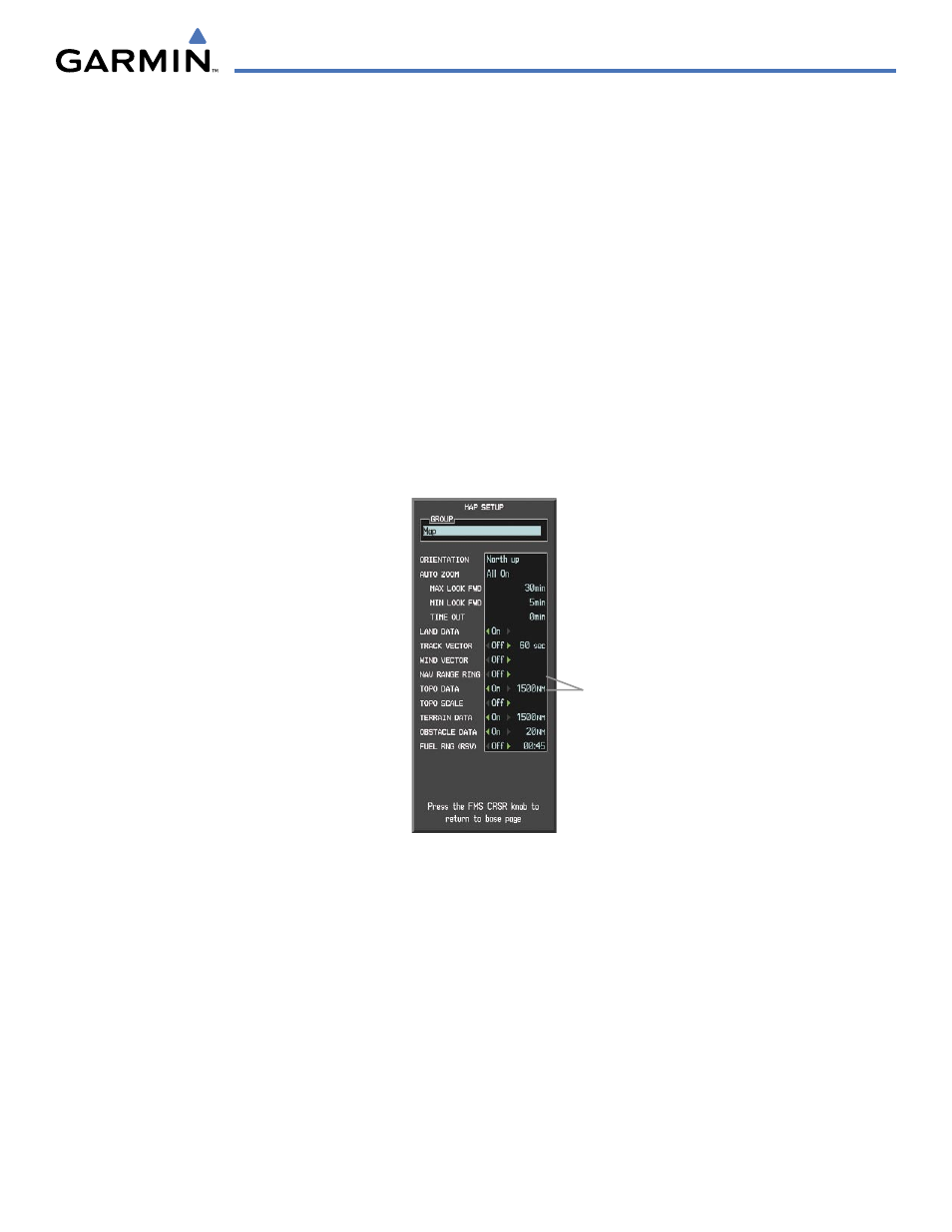
Use the Map Setup Window (Figure 6-48) to customize the display of obstacle and terrain data on the
Navigation Map Page. Data displays only if it is enabled.
Customizing terrain and obstacle display on the Navigation Map Page:
1)
On the Navigation Map Page, press the MENU Key.
2)
While the ‘Map Setup’ selection is highlighted on the Page Menu, press the ENT Key.
3)
Turn the small FMS Knob to display the group selection window. To select the ‘Map’ group, turn the FMS Knob
and press the ENT Key.
4)
While the Map Setup Menu is displayed, turn the large FMS Knob to highlight and move between ‘TERRAIN
DATA’ and ‘OBSTACLE DATA’.
5)
Turn the large FMS Knob to highlight the zoom range at which terrain and obstacles begin to display on the
Navigation Map.
6)
Turn the small FMS Knob to scroll through the ranges and press the ENT Key.
Figure 6-48 Map Setup Window
Map Zoom Range at
Which Data Begins to
Display
Refer to Table 6-5 for the altitudes associated with obstacle and terrain colors.