Gps navigation – Garmin G1000 Piper PA32 User Manual
Page 160
GPS NAVIGATION
190-00692-00 Rev. B
5-26
190-00692-00 Rev. B
Garmin G1000 Pilot’s Guide for Piper PA32
Creating user waypoints from the Navigation Map Page:
1)
With the Navigation Map Page displayed, press the
Joystick
to activate the panning function. The Map Pointer
is displayed at the present aircraft position.
2)
After placing the map arrow at the desired position, press the ENT Key. The User Waypoint Information Page is
displayed with the captured position.
3)
Enter a waypoint name.
4)
Press the ENT Key to accept the selected name. The first reference waypoint field is highlighted.
5)
If desired, enter the identifier of the reference waypoint and the radial and distance to the reference waypoint.
6)
Press the ENT Key to accept.
7)
Press the FMS
Knob to remove the flashing cursor.
D
ISPLAYING
T
OPOGRAPHIC
D
ATA
ON
THE
M
AP
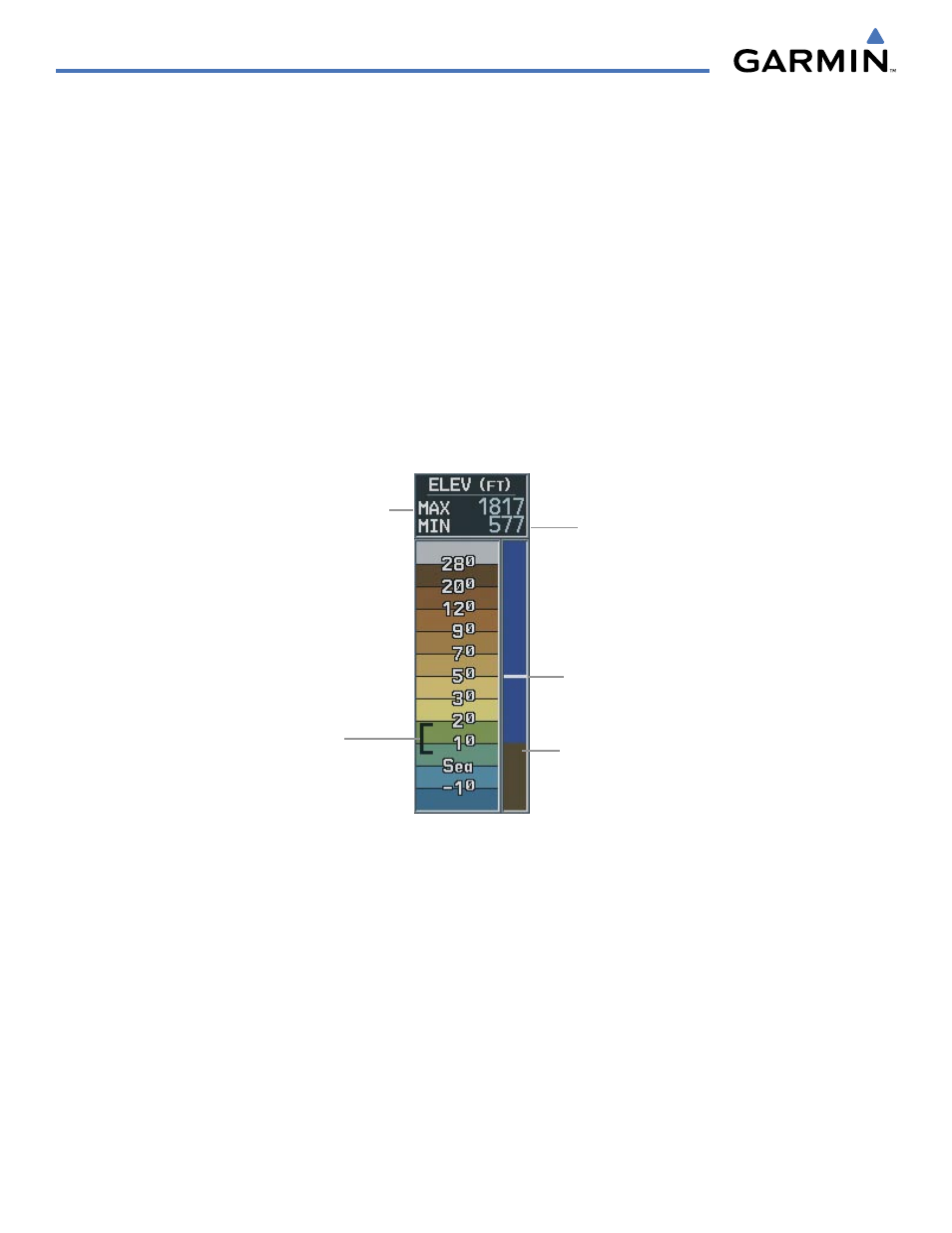
Maximum
elevation of topography
presently displayed on-
screen
Minimum
elevation of
topography
presently displayed
on-screen
Ground elevation
at present aircraft
position
Aircraft altitude
Figure 5-18 Topography Scale
Range of
topography
elevation presently
displayed on-screen
The Navigation Map displays various shades of topography land colors representing the rise and fall
of land elevation, similar to aviation sectional charts (Figure 5-18). The Navigation Map can display a
topographic range representing various key points of terrain elevation colors with their associated elevation
values labeled.
Displaying topographic data on the Navigation Map:
1)
Press the MAP Softkey.
2)
Press the TOPO Softkey. Topographic data can also be displayed on the Navigation Map by using the ‘On/Off’
topo data map setup feature. See the Navigation Map Page Setup Menu Section for more information.
3)
Press the TOPO Softkey again to remove topo data from the Navigation Map. When topographic data is removed
from the page, the Jeppesen Nav data is presented on a black background.