Navigation map page, Hazard avoidance – Garmin G1000 Piper PA32 User Manual
Page 322
Garmin G1000 Pilot’s Guide for Piper PA32
190-00692-00 Rev. B
6-42
HAZARD AVOIDANCE
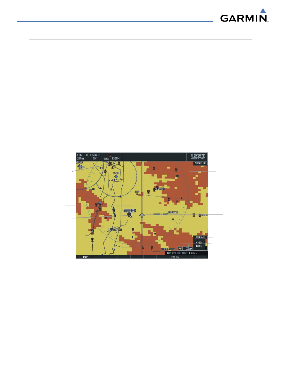
NAVIGATION MAP PAGE
Terrain and obstacle data can be displayed on the Navigation Map Page. Obstacles are shown on the Navigation
Map Page at or below the map range that is configured.
Displaying Terrain Proximity data on the Navigation Map Page:
1)
Press the MAP Softkey.
2)
Press the TERRAIN Softkey to display the terrain and obstacle data on the Navigation Map Page.
Displaying obstacle information:
1)
Press the MAP Softkey.
2)
Press the TERRAIN Softkey to display the terrain and obstacle data on the Navigation Map Page.
3)
Press the Joystick and move the panning arrow over the obstacle icon.
4)
Press the ENT Key.
Cursor Placed
on Lighted
Obstacle
Aircraft Symbol
Yellow Terrain
Area (Between
100’ and 1000’
Below Aircraft
Altitude)
Terrain Legend
Terrain Symbol
and Range
Red Lighted
Obstacles
(Above or
Within 100’
Below Aircraft
Altitude)
Red Terrain
Area (Above
or Within
100’ Below
Aircraft
Altitude)
Figure 6-47 Terrain Information on the Navigation Map Page
Panning Information
About Obstacle