Displaying traffic data, Hazard avoidance – Garmin G1000 King Air C90GT User Manual
Page 382
Garmin G1000 Pilot’s Guide for the Hawker Beechcraft C90A/GT
190-00663-01 Rev. A
368
HAZARD AVOIDANCE
SY
STEM
O
VER
VIEW
FLIGHT
INSTRUMENTS
EIS
AUDIO P
ANEL
& CNS
FLIGHT
MANA
GEMENT
HAZARD
AV
OID
ANCE
AFCS
ADDITIONAL FEA
TURES
APPENDICES
INDEX
DISPLAYING TRAFFIC DATA
Traffic information is displayed on the following maps:
• PFD Inset Map
• Navigation Map Page
• Traffic Map Page
• Trip Planning Page
• Nearest Pages
• Active Flight Plan Page
Displaying traffic on the Traffic Map Page:
1)
Turn the large FMS Knob to select the Map Page Group.
2)
Turn the small FMS Knob to select the Traffic Map Page.
3)
Turn the RANGE Knob clockwise to display a larger area or counter-clockwise to display a smaller area.
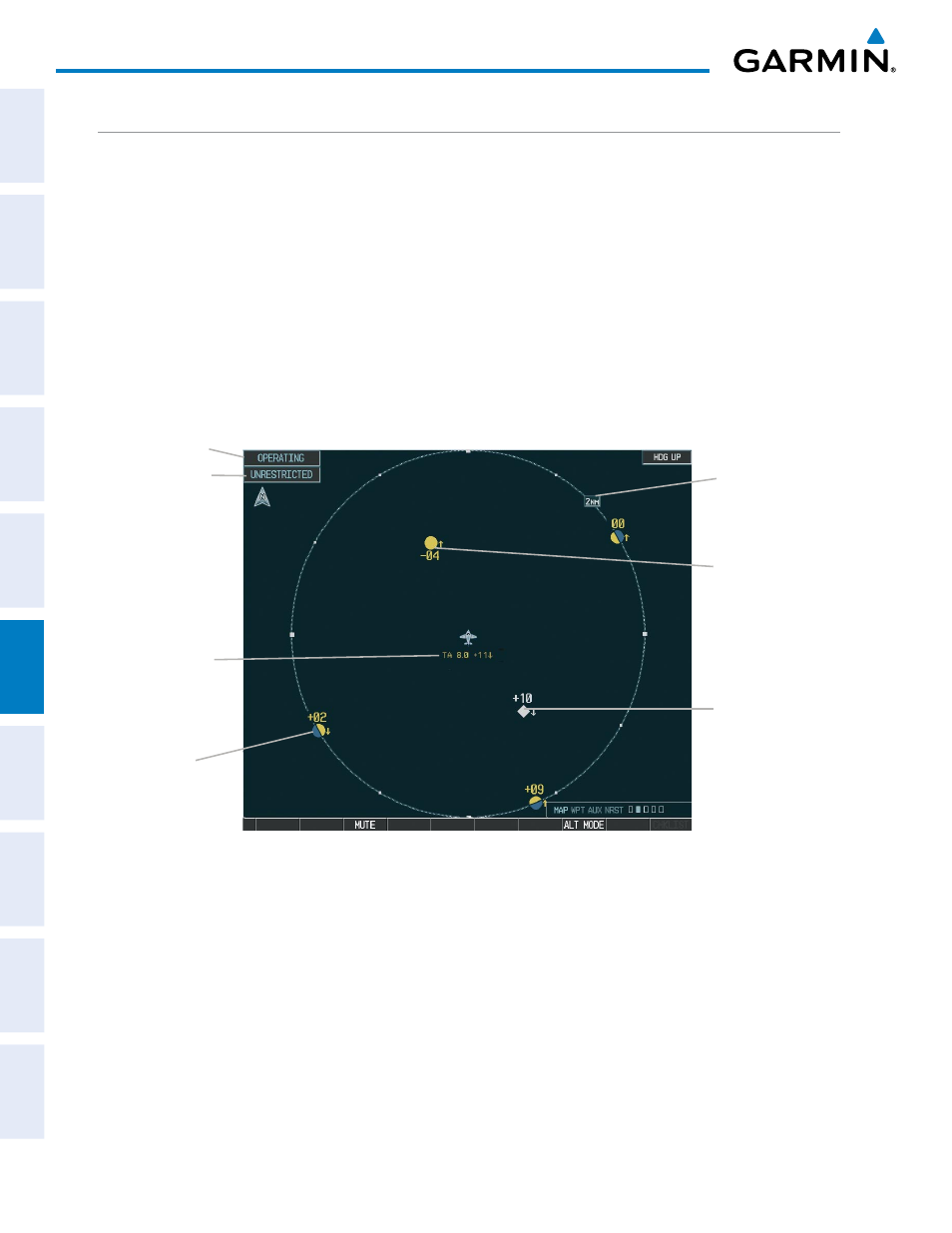
Figure 6-93 Traffic Map Page
Operating
Mode
Altitude
Mode
Traffic
Advisory,
Aircraft is
400’ Below,
Climbing
Off Scale
Traffic
Proximity
Advisory,
1000’ Above,
Descending
Traffic Display
Range
“Non-Bearing”
Traffic (Bearing
Undetermined),
Distance 8.0 nm,
1100’ Above,
Descending
The Traffic Map Page shows surrounding TAS traffic data in relation to the aircraft’s current position and
altitude, without basemap clutter. Aircraft orientation is always heading up unless there is no valid heading.
Map range is adjustable with the RANGE Knob from 2 to 24 nm, as indicated by the map range rings.
The traffic mode and altitude display mode are annunciated in the upper left corner.
Displaying traffic information (maps other than the Traffic Map Page):
1)
Select the MAP Softkey.
2)
Select the TRAFFIC Softkey to display traffic data.