Hazard avoidance, Surface analysis and city forecast – Garmin G1000 King Air C90GT User Manual
Page 325
190-00663-01 Rev. A
Garmin G1000 Pilot’s Guide for the Hawker Beechcraft C90A/GT
311
HAZARD AVOIDANCE
SY
STEM
O
VER
VIEW
FLIGHT
INSTRUMENTS
EIS
AUDIO P
ANEL
& CNS
FLIGHT
MANA
GEMENT
HAZARD
AV
OID
ANCE
AFCS
ADDITIONAL
FEA
TURES
APPENDICES
INDEX
To display the METAR legend (Figure 6-26) on the Weather Data Link Page, select the LEGEND Softkey
when METARs are selected for display.
The METAR flag color is determined by the information in the METAR text. A gray METAR flag is displayed
when the METAR text does not contain adequate information.
Figure 6-26 METAR Legend
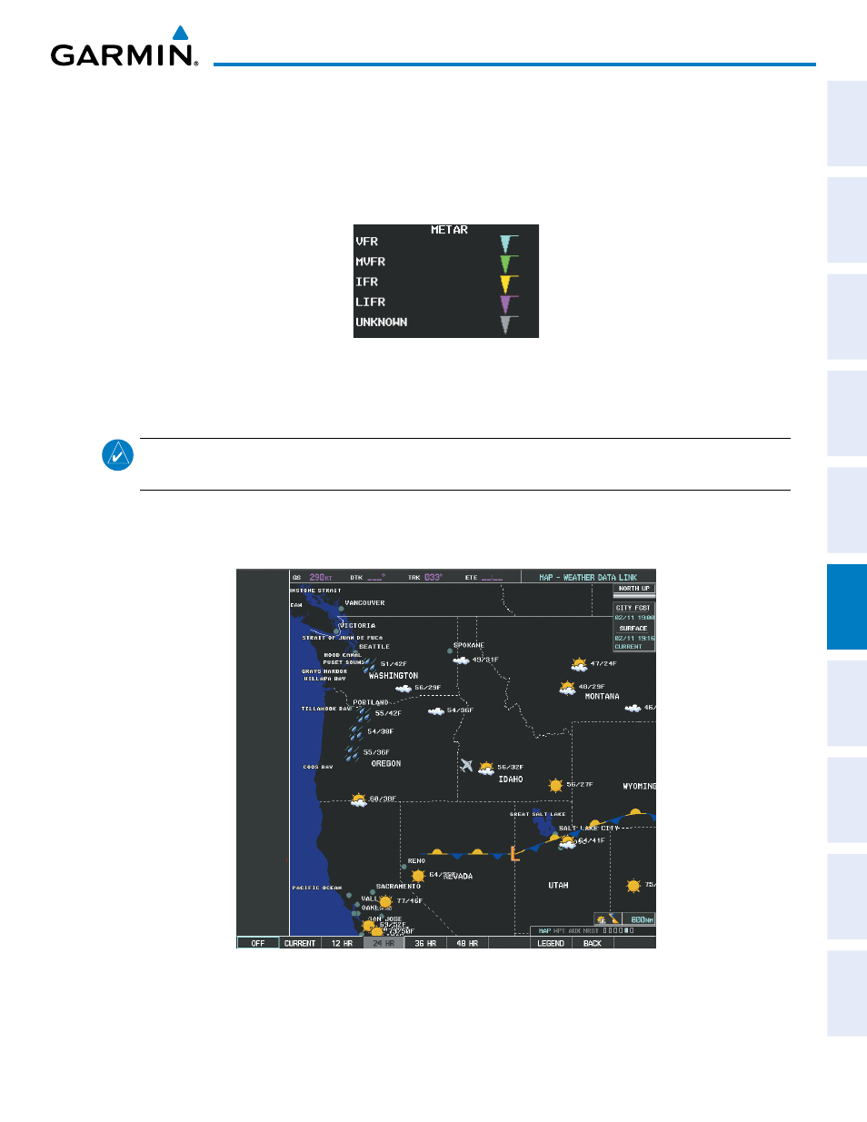
SURFACE ANALYSIS AND CITY FORECAST
NOTE:
Surface Analysis and City Forecast data are displayed only within the installed Aviation Database
service area.
Surface Analysis and City Forecast (Figure 6-27) information is available for current and forecast weather
conditions. Forecasts are available for intervals of 12, 24, 36, and 48 hours.
Figure 6-27 Surface Analysis Data - 24-Hour