Displaying traffic data, Hazard avoidance – Garmin G1000 King Air C90GT User Manual
Page 374
Garmin G1000 Pilot’s Guide for the Hawker Beechcraft C90A/GT
190-00663-01 Rev. A
360
HAZARD AVOIDANCE
SY
STEM
O
VER
VIEW
FLIGHT
INSTRUMENTS
EIS
AUDIO P
ANEL
& CNS
FLIGHT
MANA
GEMENT
HAZARD
AV
OID
ANCE
AFCS
ADDITIONAL FEA
TURES
APPENDICES
INDEX
DISPLAYING TRAFFIC DATA
Traffic information can be displayed on the following maps (when TIS is operating):
• PFD Inset Map
• Navigation Map Page
• Traffic Map Page
• Trip Planning Page
• Nearest Pages
• Active Flight Plan Page
Traffic information is also displayed on the PFD when the Synthetic Vision System (SVS) option is installed and
enabled. See the Additional Features Section for details.
Displaying traffic information (maps other than the Traffic Map Page):
1)
Select the MAP Softkey.
2)
Select the TRAFFIC Softkey. Traffic is now displayed on the map.
When traffic is selected on maps other than the Traffic Map Page, an icon is shown to indicate the feature is
enabled for display.
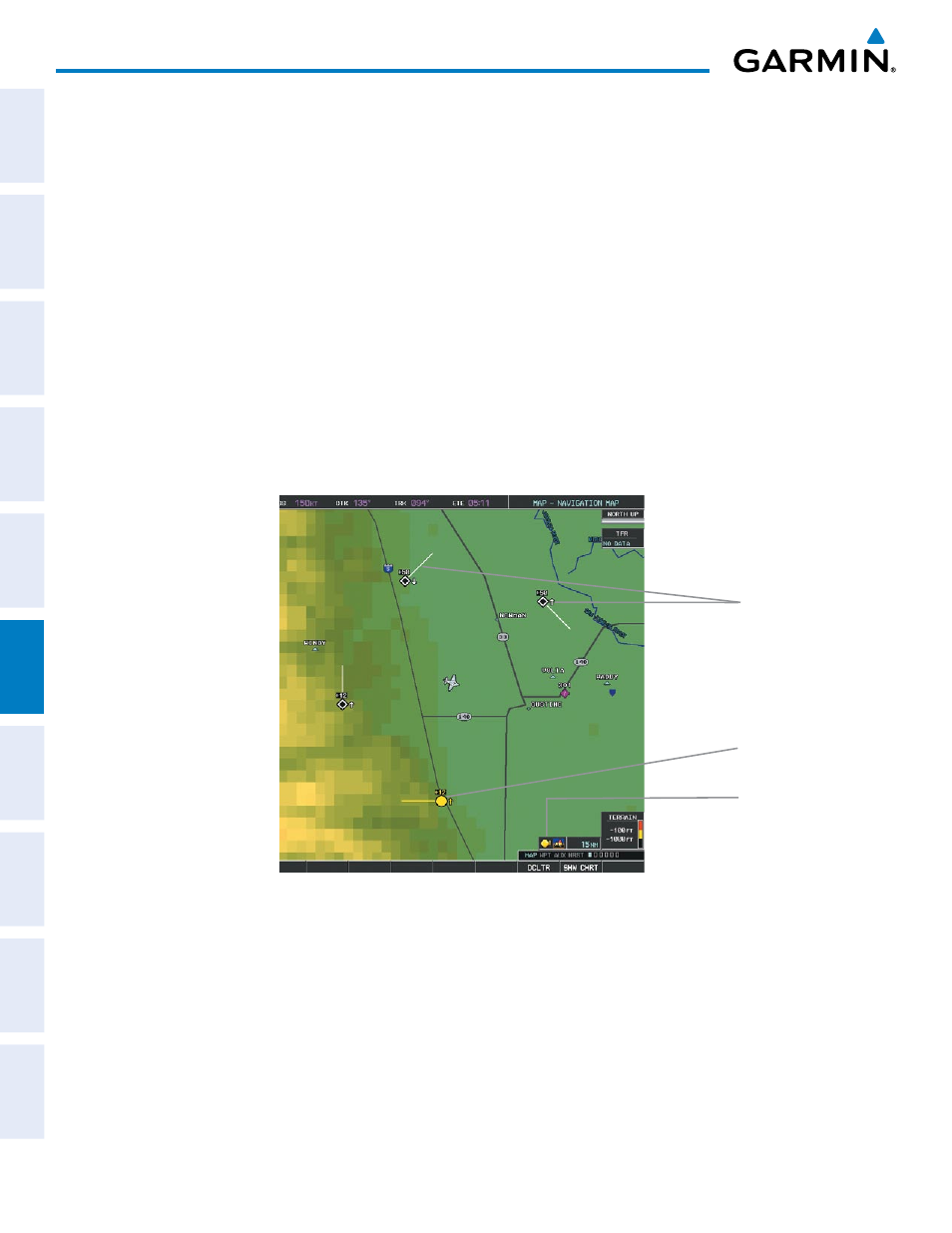
Figure 6-86 TIS Traffic on the Navigation Map Page
Traffic
Advisory
Traffic
Display
Enabled
Non-
Threat
Traffic
Displaying traffic information (PFD Inset Map):
1)
Select the INSET Softkey.
2)
Select the TRAFFIC Softkey to display traffic data on the inset map (TRFC-1).
3)
Select the TRAFFIC Softkey again to display the traffic-only inset (TRFC-2).
4)
Select the TRAFFIC Softkey again to remove traffic data.