Softkey function, System overview, Pfd softkeys – Garmin G1000 King Air C90GT User Manual
Page 34
190-00663-01 Rev. A
Garmin G1000 Pilot’s Guide for the Hawker Beechcraft C90A/GT
20
SYSTEM OVERVIEW
SY
STEM
O
VER
VIEW
FLIGHT
INSTRUMENTS
EIS
AUDIO P
ANEL
& CNS
FLIGHT
MANA
GEMENT
HAZARD
AV
OID
ANCE
AFCS
ADDITIONAL FEA
TURES
APPENDICES
INDEX
SOFTkEY FUNCTION
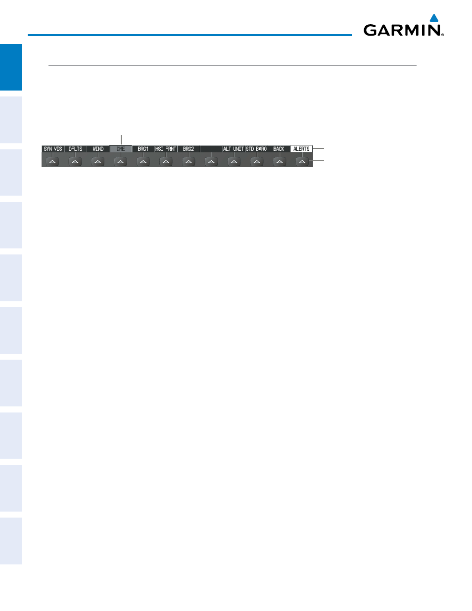
The softkeys are located along the bottoms of the displays. The softkeys shown depend on the softkey level
or page being displayed. The bezel keys below the softkeys can be used to select the appropriate softkey. When
a softkey is selected, its color changes to black text on gray background and remains this way until it is turned
off, at which time it reverts to white text on black background.
Softkey Names (displayed)
Figure 1-15 Softkeys (Second-Level PFD Configuration)
Bezel-Mounted Softkeys (press)
Softkey On
Another means of selecting softkeys on the MFD is by using the GCU 475 Control Unit:
Selecting a softkey using the Control Unit
1)
Move the softkey selection box to the desired softkey using the arrows of the SEL Key.
2)
Press the center of the SEL Key to select the desired softkey.
PFD SOFTKEYS
The CDI, IDENT, TMR/REF, NRST, and ALERTS Softkeys undergo a momentary change to black text
on gray background and automatically switch back to white text on black background when selected. If
messages remain after acknowledgement, the ALERTS Softkey is black on white.
The PFD softkeys provide control over flight management functions, including GPS, NAV, terrain, traffic,
and lightning (optional). Each softkey sublevel has a BACK Softkey which can be pressed to return to
the previous level. The ALERTS Softkey is visible in all softkey levels. For the top level softkeys and the
transponder (XPDR) levels, the IDENT Softkey remains visible.
INSET
Displays Inset Map in PFD lower left corner
OFF
Removes Inset Map
DCLTR (3)
Selects desired amount of map detail; cycles through declutter levels:
DCLTR (No Declutter): All map features visible
DCLTR-1: Declutters land data
DCLTR-2: Declutters land and SUA data
DCLTR-3: Removes everything except for the active flight plan
TRAFFIC
Displays traffic information on Inset Map
TRAFFIC: No Traffic displayed on Inset Map
TRFC-1: Traffic displayed on Inset Map
TRFC-2: Traffic Only display shown
TOPO
Displays topographical data (e.g., coastlines, terrain, rivers, lakes) and elevation
scale on Inset Map
TERRAIN
Displays terrain information on Inset Map