Ag leader technology, Reference – Ag Leader GPS 2100 Operators Manual User Manual
Page 75
GPS 2000/2100
Reference:
Ag Leader Technology
April 1998
8-7
Advanced Ag Leader
Format
This format is used to output data in a format that most of the
currently available software can map. This format is the same as that
used to export data from the Yield Monitor 2000. If the mapping
software you are using supports the Advanced format used with the
Yield Monitor 2000, then the data from the GPS 2000/2100 can be
imported.
The following is a description of the information in the Advanced Ag
Leader export file:
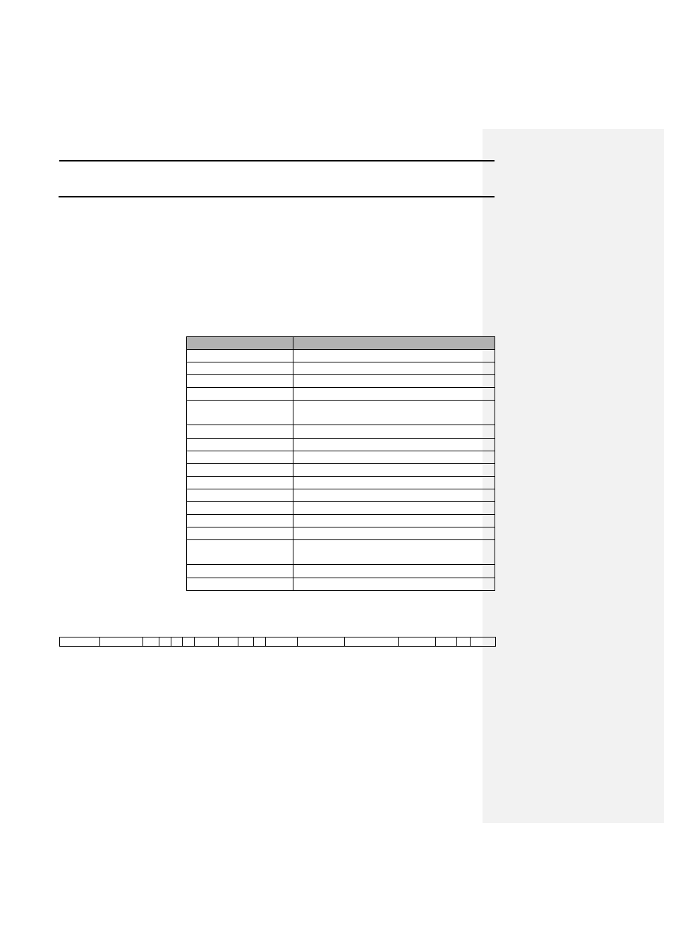
Variable
Description
Longitude
Displayed in dd.dddddd
Latitude
Displayed in dd.dddddd
Flow
Fixed value of .5
Time
60 second cycle going from 1-60.
Logging Interval
Displays the current time interval between
logged points in seconds.
Distance
Fixed value of 1.
Swath
Fixed value of 360.
Moisture
Fixed to 13%.
Marker data
Bits 1-4 mask as Marker data.
Pass
Fixed to 0.
Serial Number
Fixed to 970101.
Field Name
Indicates the field number and name.
Data Type
Indicates the data type number and name.
Grain
Fixed to corn.
GPS Status
Indicates the number of satellites and
differential status.
PDOP
Fixed to 0.
Elevation
Displayed in feet.
The following is an example of the Advanced Ag Leader export
format:
-93.62784
42.002036
.5
6
1
1
360
13
3
0
970101
F001:North
L002: Tile
Corn
13
0
935