Ag leader technology – Ag Leader GPS 2100 Operators Manual User Manual
Page 27
GPS 2000/2100
Operation
Ag Leader Technology
Apri1998
3-9
keys.
LOCATION
Move the cursor down besides
SWC LAT: using the right arrow
key. Use the UP/DOWN arrow
keys to enter the desired latitude
and then repeat the process
above to enter in the longitude.
6
Once the scale mode has been set , press ENTER to return to the
mapping menu screen and turn mapping on by pressing the F1 key.
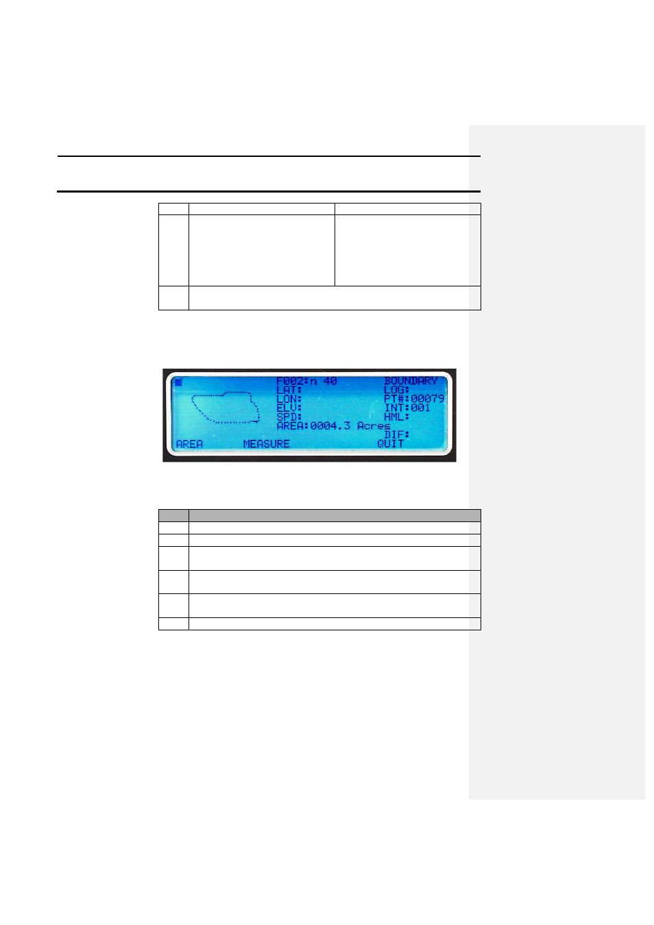
Calculating area
If the user logs points in a manor that generates a perimeter map, such as a
boundary map (shown below), then the total area can be displayed for the
enclosed area.
The following describes how to display the area of an enclosed data set:
Step
Action
1
Set the unit standard mode.
2
Press the MARK key.
3
Select the field that contains data that will be used to calculate the
area or collect the data now.
4
After the field is selected or the data is recorded, press the SETUP
key until AREA is displayed above the F1 key. Press the F1 key.
5
AREA: should now replace MRK: and the area in acres will be
displayed after a few moments.
6
Press the F4 key to return to normal MARK mode.
Tape measure feature
Using this feature allows the user to drive from one point to another and
display a straight-line distance as well as the path distance on the screen. A
map of the distance traveled is also displayed. The following photo
illustrates the tape measure feature and the text following the photo details
the screen options and values: