Ag leader technology, Operation – Ag Leader GPS 2100 Operators Manual User Manual
Page 24
Operation
GPS 2000/2100
Ag Leader Technology
April 1998
3-6
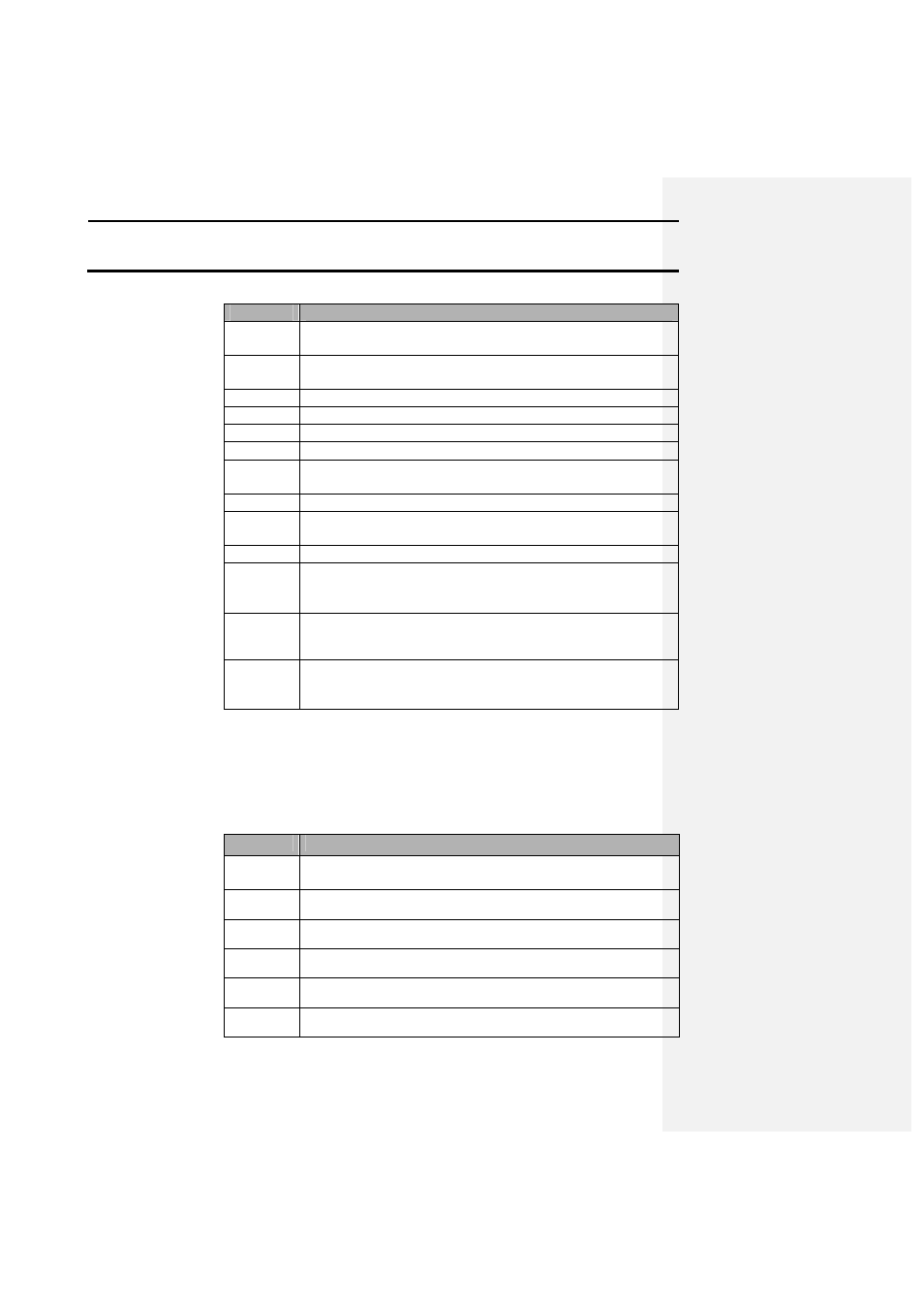
Description
F000:XX
The field number and name the user selects in which to log
data. This can be edited using the EDIT FLD option.
Boundary
Data type that the data will log as. Can be edited using the
EDIT FLD option.
LAT:
Current latitude in ddmm.mmmm.
LON:
Current longitude in ddmm.mmmm.
ELV:
Current elevation in feet.
SPD:
Current speed in mph.
MRK:
Displays the mark that is being marked continuously if a
continuous mark is selected.
LOG:
Displays whether logging is turned on or off.
PT#:
Displays the number of points that have been collected in a
field.
INT:
Displays the selected logging interval.
HML:
Hours and minutes left. This indicates the amount of time left
in the interval memory to log points on the current logging
interval.
Mark01
One of four current marks that the user can select by pressing
the corresponding F key below the mark name.
DIFF:
This tells you whether you are receiving a differential
correction signal. It will be either ON or OFF
On-Screen Map
This function allows the user to see the lines and boundaries that they have
created. It also allows a person to display the number of acres in a
boundary.
Step
Action
1
From the standard mode press the Mark key, this will put you
into the Mark mode.
2
Select the field that has known data points logged into it.
3
Press the setup key.
4
Press F1 to turn the map on.
5
Press the setup key.
6
Press the area key to display the acres in the boundary.