Ag leader technology, Reference – Ag Leader GPS 2100 Operators Manual User Manual
Page 74
Reference:
GPS 2000/2100
Ag Leader Technology
April 1998
Export Formats
The GPS 2000/2100 is capable of exporting data in two different formats;
GPS 2000/2100 internal format, and Advanced Ag Leader format.
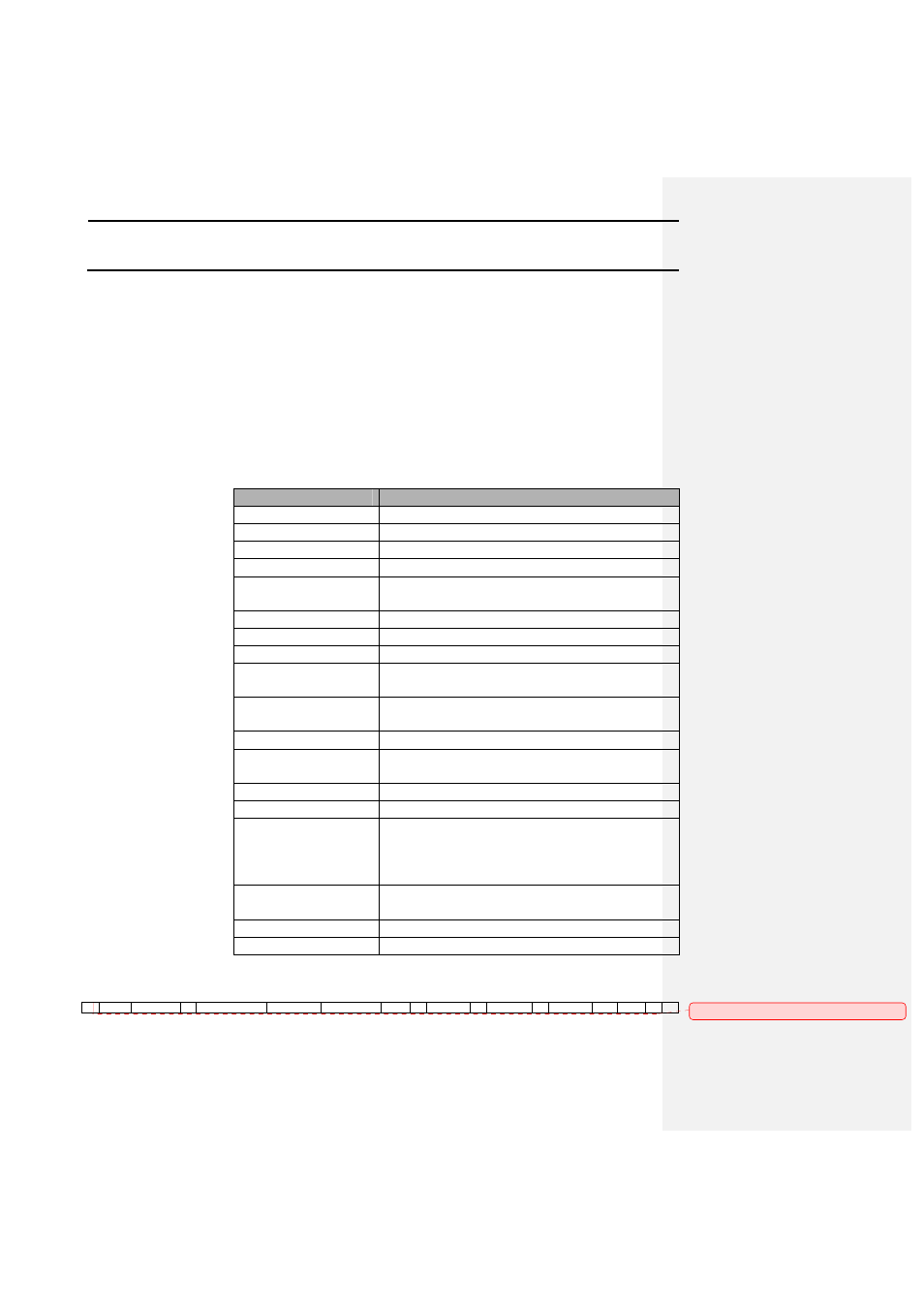
GPS 2000/2100 Format Format that the GPS 2000/2100 uses to store data internally. It provides a
variety of information in regard to location and conditions that points were
logged under. A future release of Precision Map 2000 will support this
data format, third-party support of this format should follow shortly after.
The following is a description of the information in the GPS 2000/2100
internal export file:
Variable
Description
Record Type Number Indicates the type of data stored.
Field Number
Indicates the field number between 0-255.
Field Name
Indicates the 8-character field name.
Data Type Number
Number between 0-19 that indicates a data type.
Data Type Name
Data type name corresponding to the data type
number
Latitude
Expressed in dd.dddddd
Longitude
Expressed in dd.dddddd
Elevation
In feet.
Continuous Mark
Number
Number between 0-31 that indicates a continuous
mark.
Continuous Mark
Name
Name that corresponds with the Cont. Mark
Number.
Spot Mark Number
Number between 0-31 that indicates a spot mark.
Spot Mark Name
Name that corresponds with the Spot Mark
Number.
Seconds
Count from 1-60 seconds that resets at 60.
Date
The date in yymmdd format.
GPS Status
Indicates number of satellites and differential
status.
Upper 4 - bits = Number of satellites
Lower 4 - bits = Differential status
Beacon ID
Beacon station reference ID based on the beacon
being used.
Velocity
Speed in MPH.
USER 1
Unused location.
The following is an example of the GPS 2000/2100 export file:
1
255
North 80
0
BOUNDARY
42002036
-93627840
935
2
Mark 3
1
Mark 2
4
970317
82
157
0
0
Comment [VGC1]: