Ag leader technology – Ag Leader GPS 2100 Operators Manual User Manual
Page 32
Operation
GPS 2000/2100
Ag Leader Technology
April 1998
3-14
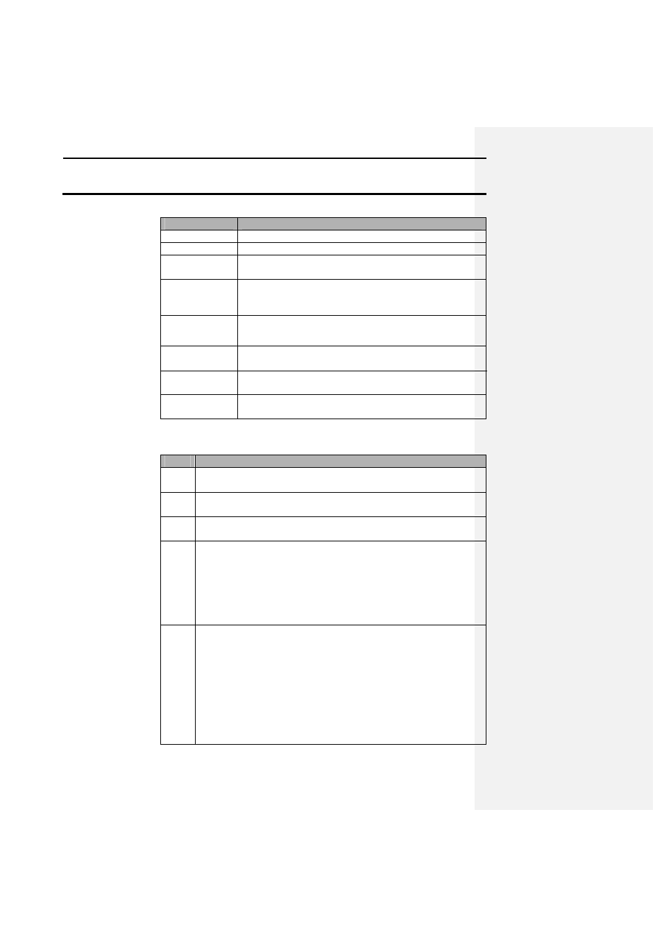
Field
Description
FLD: 152
Indicates the field number the user has selected.
FNM: North 40
Shows the name entered for the selected field number.
PT#: 0002
Allows the user to increment through each individual
point that was logged into the selected field.
SMK:
Indicates that there is a spot mark in the data for the
LAT/LON displayed. The user also can scroll from mark
to mark in the selected field.
CMK:
Same as SMK:, but it displays only marks made using
the continuous mark function.
LAT:
Displays the latitude of the current point to which you
will navigate in degrees-decimal degrees.
LON:
Displays the longitude of the current point to which you
will navigate in degrees-decimal degrees
Compass
Directions
Displays the distance in feet you must drive in a direction
to reach the desired location.
Navigating to a Point
or Mark
Follow these steps to navigate to a point or mark:
Step
Action
1
Press the NAV key to access navigation mode. The cursor should
flash on the last digit of FLD: 000 or the last FLD selected.
2
Use the directional arrow keys to increment the field numbers to
the desired field.
3
Use the left or right arrow keys to move to either PT#: or
SMK:/CMK:.
4
Use the up or down arrow keys to scroll to the desired point or
mark to which you want to navigate.
Result: A distance in feet should appear on two of the compass
directions, which indicates the distance you must travel in those
directions to reach the selected location. After you reach the
selected location, the numbers should read zero.
5
Another method of navigation is to manually enter in a Latitude
and Longitude value to navigate to:
a)
From the navigation mode, press the F1 key. A flashing cursor
should now appear on the first digit of the LAT: value. Use the
UP/DOWN arrows to increment the values and the right arrow
key to move to the next value. After entering the LAT: value
enter the LON: value. As the user enters the manual location
the directional headings and distance to the location should
begin to update.
b)
To exit the manual mode for navigation press the ENTER key.