Appendix g miscellaneous, Obstacle database colors and symbols, Terrain proximity/taws color chart – Garmin G1000 Mooney M20TN User Manual
Page 375
190-00647-00 Rev. A
Garmin G1000 Pilot’s Guide for the Mooney M20M/M20R/M20TN
G-3
APPENDIX G
MISCELLANEOUS
Item
Symbol
ARTCC Frequency or FSS Frequency
Map Pointer
Elevation Pointer
Measuring Pointer
Overzoom Indicator
Item
Symbol
Terrain Proximity Enabled
Traffic Enabled
User Waypoint
Wind Vector
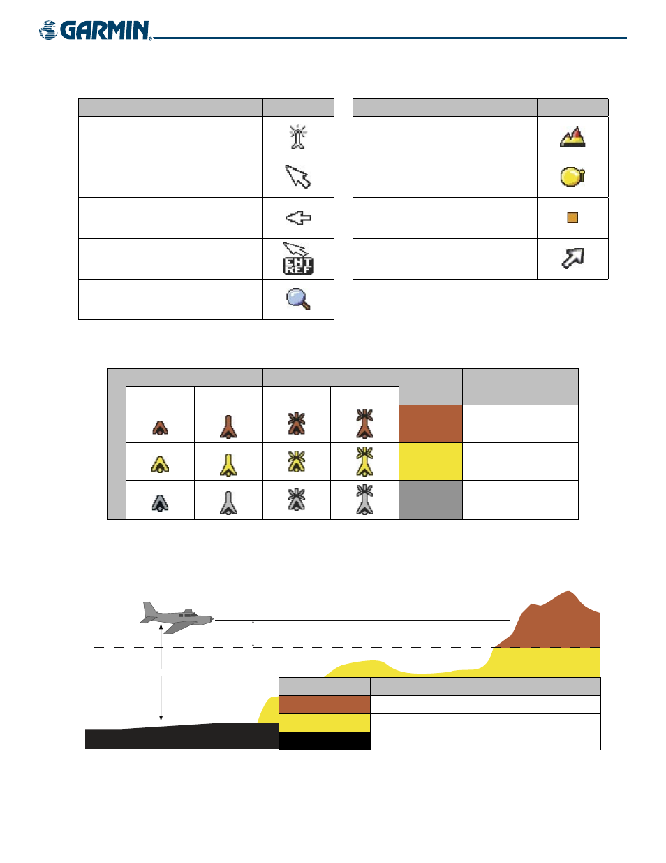
OBSTACLE DATABASE COLORS AND SYMBOLS
Unlighted Obstacle
Lighted Obstacle
Obstacle
Color
Obstacle Location
< 1000 ft AGL > 1000 ft AGL < 1000 ft AGL > 1000 ft AGL
Obstacle Symbol
Red
(WARNING)
Obstacle within 100 ft or
above aircraft altitude
Yellow
(CAUTION)
Obstacle within 1000 ft
of aircraft altitude
Gray
Obstacle more than 1000
ft below aircraft altitude
Table G-1 Obstacle Symbols and Colors
TERRAIN PROXIMITY/TAWS COLOR CHART
�������
�����������������
�����������������
Terrain Color
Terrain Location
Red (WARNING)
Terrain at or within 100 ft below aircraft altitude
Yellow (CAUTION) Terrain between 100 ft and 1000 ft of aircraft altitude
Black
Terrain more than 1000 ft below aircraft altitude
Figure G-1 Terrain Colors