Hazard avoidance – Garmin G1000 Mooney M20TN User Manual
Page 273
190-00647-00 Rev. A
Garmin G1000 Pilot’s Guide for the Mooney M20M/M20R/M20TN
6-37
HAZARD AVOIDANCE
Changing the viewing mode between 360° and ARC:
1)
Select the Terrain Proximity Page.
2)
Press the
VIEW
Softkey.
3)
Press the 360 or ARC Softkey to select the desired view.
OR
:
1)
Press the MENU Key. The page menu is displayed with either ‘View 120º’ or ‘View 360º’. Press the ENT Key
to change the view.
2)
Turn the Joystick clockwise to display a larger area or counter-clockwise to display a smaller area. Map ranges
are 1 nm, 1 and 2 nm, 2.5 and 5 nm, 5 and 10 nm, 12.5 and 25 nm, 25 and 50 nm, 50 and 100 nm, and 100
and 200 nm.
Other aviation information such as airports, VORs, and other NAVAIDS can be displayed on the Terrain
Proximity Page.
Showing or hiding aviation information:
1)
Press the MENU Key.
2)
Select ‘Show (or Hide) Aviation Data’.
3)
Press the ENT Key.
4)
Press the CLR Key to toggle aviation information on or off.
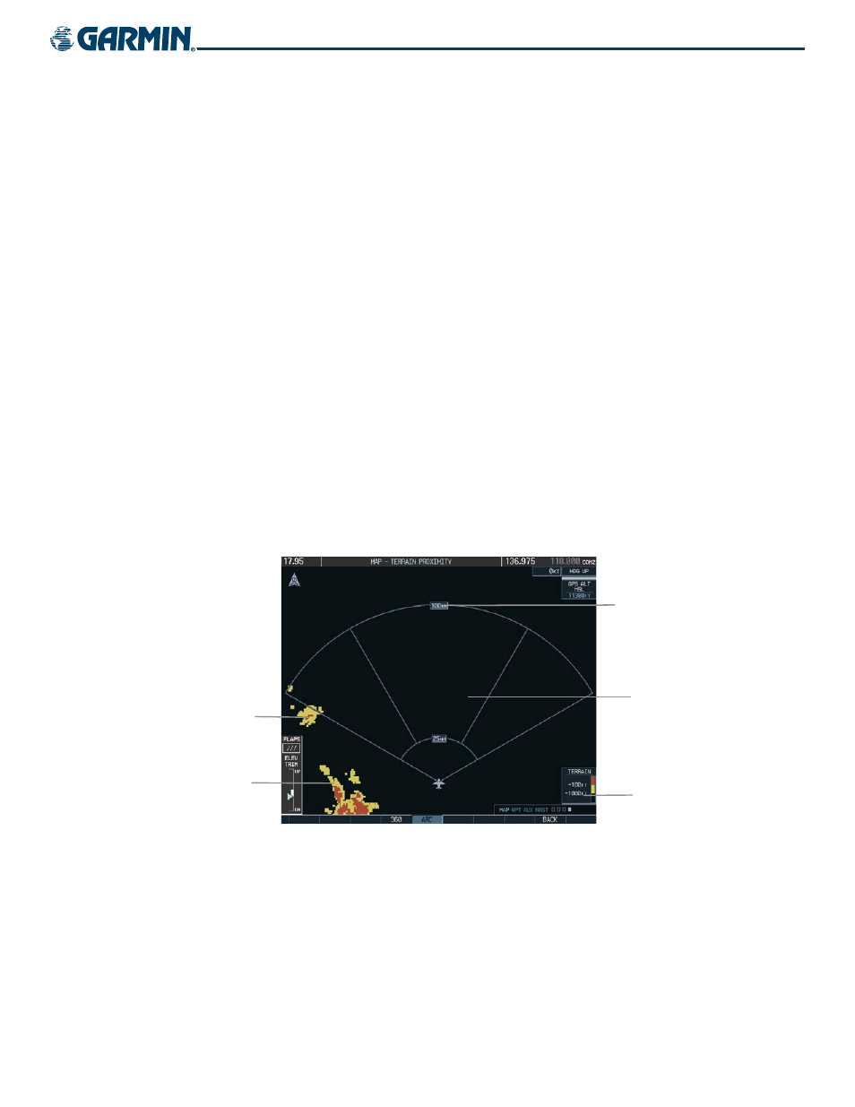
Map Range (No
Obstacles Shown
Beyond 10 nm)
Black Terrain Area
(More than 1000’
Below Aircraft Altitude)
Red Terrain Area
(Above or Within 100’
Below Aircraft Altitude
Yellow Terrain Area
(Between 100’ and
1000’ Below Aircraft
Altitude)
Figure 6-45 Terrain Proximity Page (ARC View)
Terrain Legend