Garmin G1000 Mooney M20TN User Manual
Page 275
190-00647-00 Rev. A
Garmin G1000 Pilot’s Guide for the Mooney M20M/M20R/M20TN
6-39
HAZARD AVOIDANCE
SETTING UP TERRAIN ON THE NAVIGATION MAP PAGE
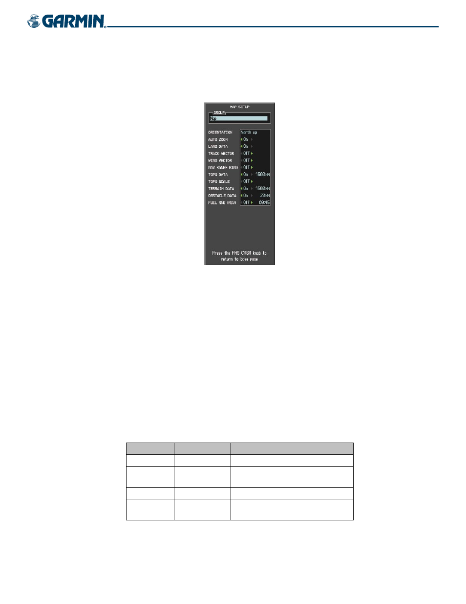
Use the Map Setup Window (Figure 6-47) to customize the display of obstacle and terrain data on the
Navigation Map Page. Data displays only if it is selected.
Figure 6-47 Map Setup Window
Setting up and customizing the Navigation Map Page:
1)
On the Navigation Map Page, press the MENU Key.
2)
While the ‘Map Setup’ selection is highlighted on the Page Menu, press the ENT Key.
3)
Turn the small FMS Knob to display the group selection window. To select the ‘Map’ group, turn the FMS Knob
and press the ENT Key.
4)
While the Map Setup menu is displayed, turn the large FMS Knob to highlight and move between the
selections.
5)
When an item is highlighted, turn the small FMS Knob to select the desired option and press the ENT Key.
Table 6-8 shows the options for displaying terrain and obstacle data on the Navigation Map only. It does
not apply to other maps.
TERRAIN DATA
OBSTACLE DATA
DISPLAYED ON NAVIGATION MAP PAGE
OFF
OFF
No obstacles or terrain displayed
OFF
ON
SAFE, CAUTION, and WARNING obstacles
displayed
ON
OFF
CAUTION and WARNING terrain displayed
ON
ON
SAFE, CAUTION, and WARNING obstacles and
terrain displayed
Table 6-8 Obstacle and Terrain Data on the Navigation Map Page