Tis symbology – Garmin G1000 Mooney M20TN User Manual
Page 292
Garmin G1000 Pilot’s Guide for the Mooney M20M/M20R/M20TN
190-00647-00 Rev. A
6-56
HAZARD AVOIDANCE
Traffic information can be displayed on the following other pages by pressing the MAP Softkey, followed by the
TRAFFIC Softkey:
• Navigation Map
• AUX - Trip Planning Page
• WPT - VOR Information Page
• Nearest Pages
• PFD Inset Map
• FPL - Active Flight Plan Page
If data is not received for a period longer than six seconds, the age of the present data will be displayed in
the lower left of the screen along with the annunciation that the system has entered Coast mode. The system
will maintain the traffic display (up to 60 seconds) until the next data reception. If no data is received after 60
seconds, traffic will be removed from the display.
TIS SYMBOLOGY
Traffic Information Service (TIS) is designed to help pilots detect and avoid aircraft intersecting their flight
path. TIS uses the Mode S transponder for the traffic data link.
TIS receives traffic information from ground stations and provides a five-second update rate. The G1000
displays up to eight traffic targets within a 7.5 nm radius, from 3,000 feet below to 3,500 feet above the
requesting aircraft. Traffic is displayed on the Traffic Map Page according to TCAS symbology. Traffic is
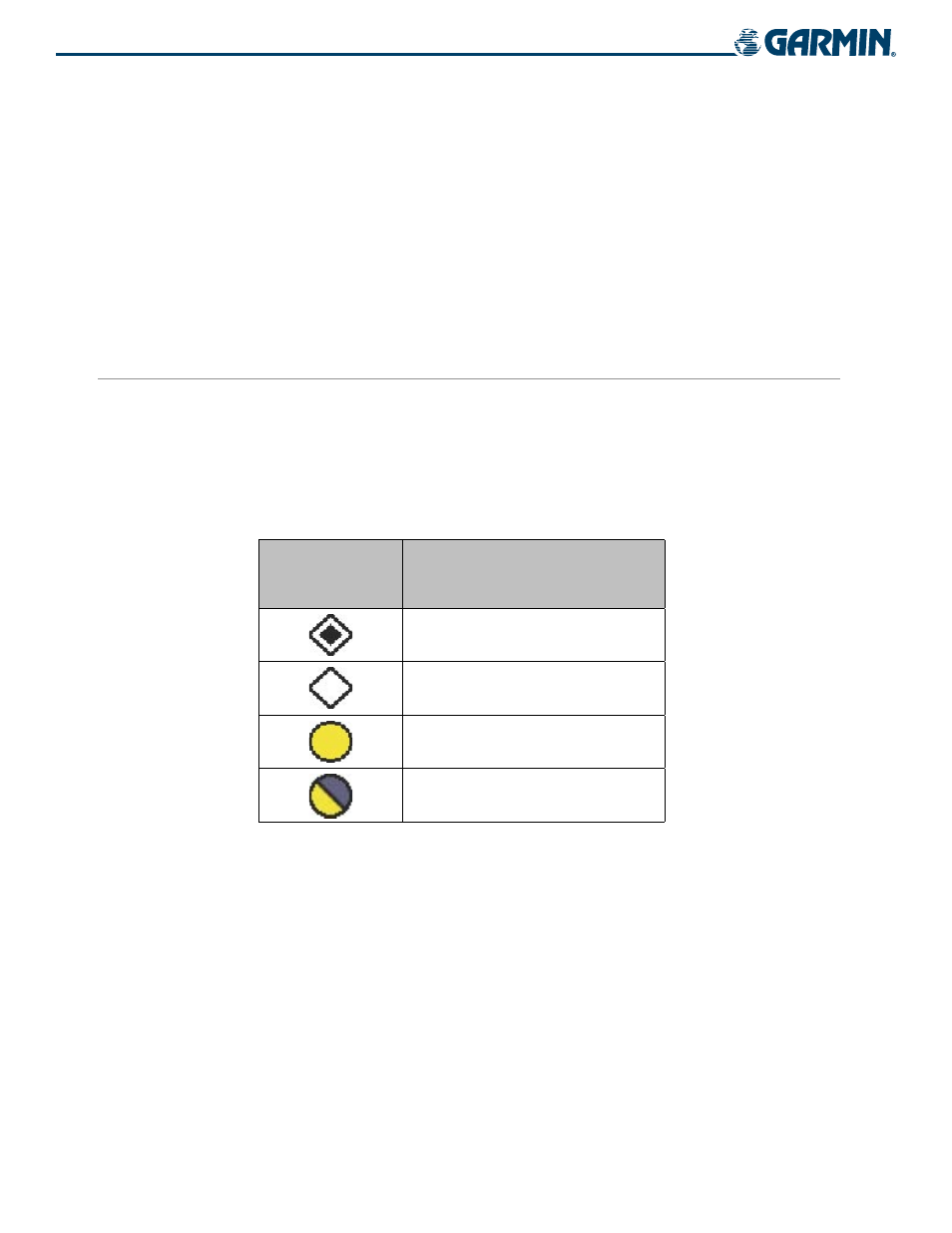
displayed using four different symbols (Table 6-13).
TIS Symbol
Description
Non Threat Traffic
Proximity Advisories (PA)
Traffic Advisories (TA)
Traffic Advisory Off Scale
Table 6-13 Additional System Annunciations
Proximity Advisories (PAs) are defined as traffic within the 5.0-nm range, within ±1200 ft. of altitude
separation. They are not Traffic Advisories (TA). When traffic meets the advisory criteria for the TA a solid
yellow circle symbol is generated. TIS provides vector lines showing the direction that the aircraft symbol is
moving.
Deviation from aircraft altitude is displayed above or below the target symbol, depending on the traffic
location. Altitude trend is displayed as an up (+500 ft/min) or down (-500 ft/min) arrow to the right of the
target symbol. If the altitude trend is less than 500 ft/min rate in either direction, no symbol displays.