Gps navigation – Garmin G1000 Mooney M20TN User Manual
Page 142
5-24
GPS NAVIGATION
190-00647-00 Rev. A
Garmin G1000 Pilot’s Guide for the Mooney M20M/M20R/M20TN
M
EASURING
B
EARING
AND
D
ISTANCE
Measure
Bearing/Distance
Option
Navigation Map
Page Menu
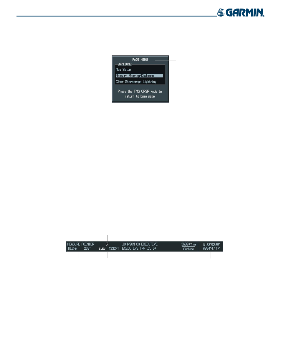
Figure 5-18 Measure Bearing/Distance Option
The second map setup option is ‘Measure Bearing/Distance’ (Figure 5-18), which provides a quick and
easy method for determining the bearing and distance between any two points on the Navigation Map.
Measuring bearing and distance between two points:
1)
Press the MENU Key (with the Navigation Map Page displayed).
2)
Highlight the ‘Measure Bearing/Distance’ field.
3)
Press the ENT Key. A reference arrow is displayed on the map at the aircraft’s present position and the window
shown in Figure 5-19 is displayed.
4)
Move the joystick to place the reference arrow at the desired location. As the arrow is being moved, a dashed
line is drawn from the reference (starting) point to its present position. The bearing and distance from the
starting point is displayed along with the new coordinates. Elevation at the current position is also displayed
(Figure 5-19). Pressing the
ENT Key changes the starting point for measuring.
5)
To exit the Measure Bearing/Distance option, push in the joystick or select ‘Stop Measuring’ from the page
menu and press the ENT Key.
Controlled Airspace
Information
Elevation
Figure 5-19 Measure Bearing/Distance Box
Distance and
Bearing to the
Selected Position
Obstacle Symbol
Lat/Lon at
Selected Position